 Routes and trips
 Map
Map MPR - cyclist-friendly places
 POI
POI Plan your trip
 Bike counters
 Publications
 News
News Route concept
 Contact
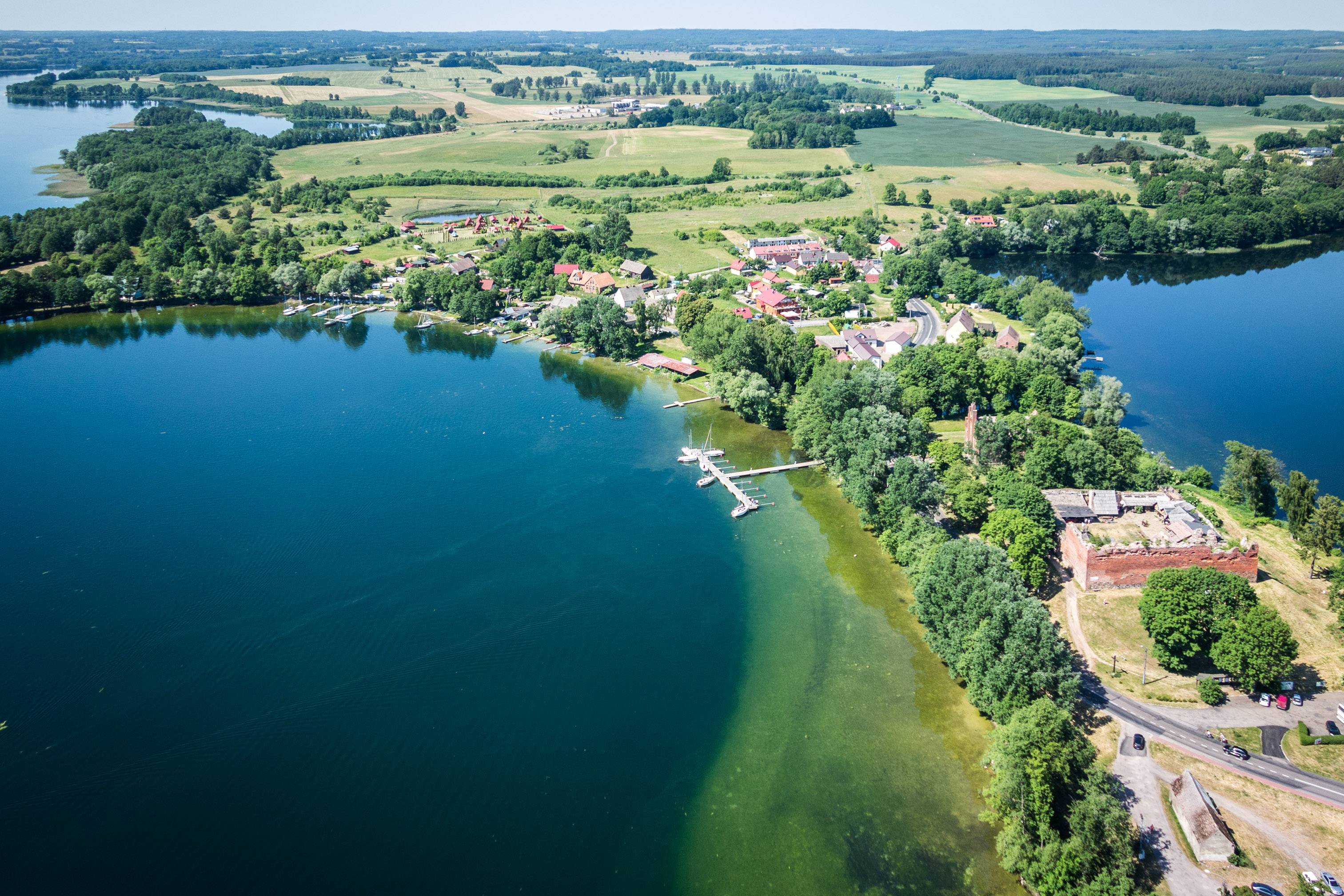
Originally, there used to be an early medieval settlement, which gave rise to the current hill with the castle, in place of the today's ruins. On 21st November 1286, Przemysł II, Duke of Greater Poland and Cracow, issued a charter giving the Order of the Knights Templar the areas located in the vicinity of the Drawa River and Lake Drawsko. In return, the knights pledged to provide Przemysł with effective protection against the increasing aggression from Brandenburg. The headquarters of the Order became Czaplinek. In 1312, Pope Clement V disbanded the financially and morally discredited Order of the Knights Templar. As a result the assets of the Templars was acquired by the Knights Hospitaller. In 1407, the castle was recaptured by the army of Władysław Jagiełło, who had ordered to capture the stronghold as a preventive measure. The Hospitallers had become enemies of the Polish king by defaming him by their diplomatic activities at European courts. In addition, the Hospitallers actively supported the Teutonic Order, which was a sufficient reason to intervene. A starosty was formed from the former commandery, the seat of which became Drahim. During the Swedish invasion, the town and the castle were burnt. In 1657, the starosty and the castle became the property of the state of Brandenburg. It happened as a result of not paying off the pledge of John Casimir. In 1758, during the war between Prussia and Russia, the castle was finally destroyed. It is true that after 1772 it was still the seat of the land tax office, but it was no longer its primary role.
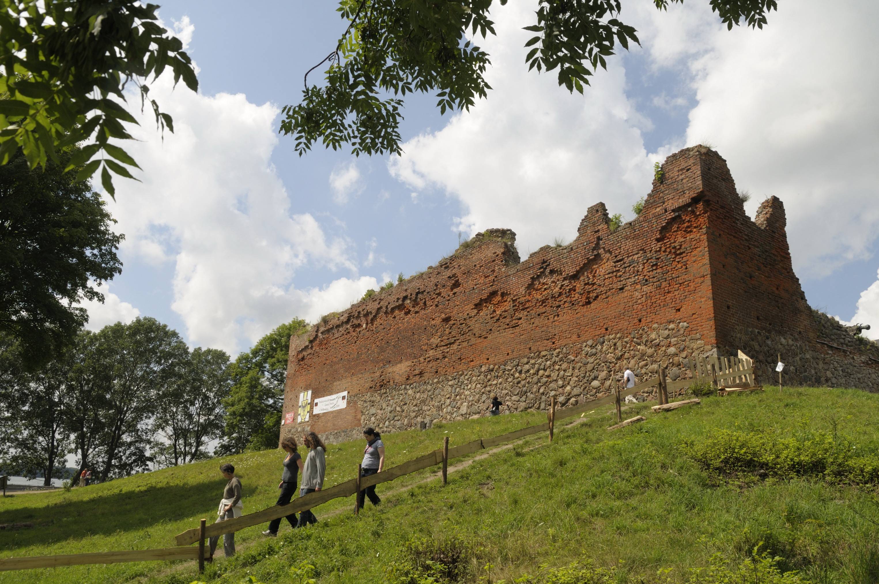
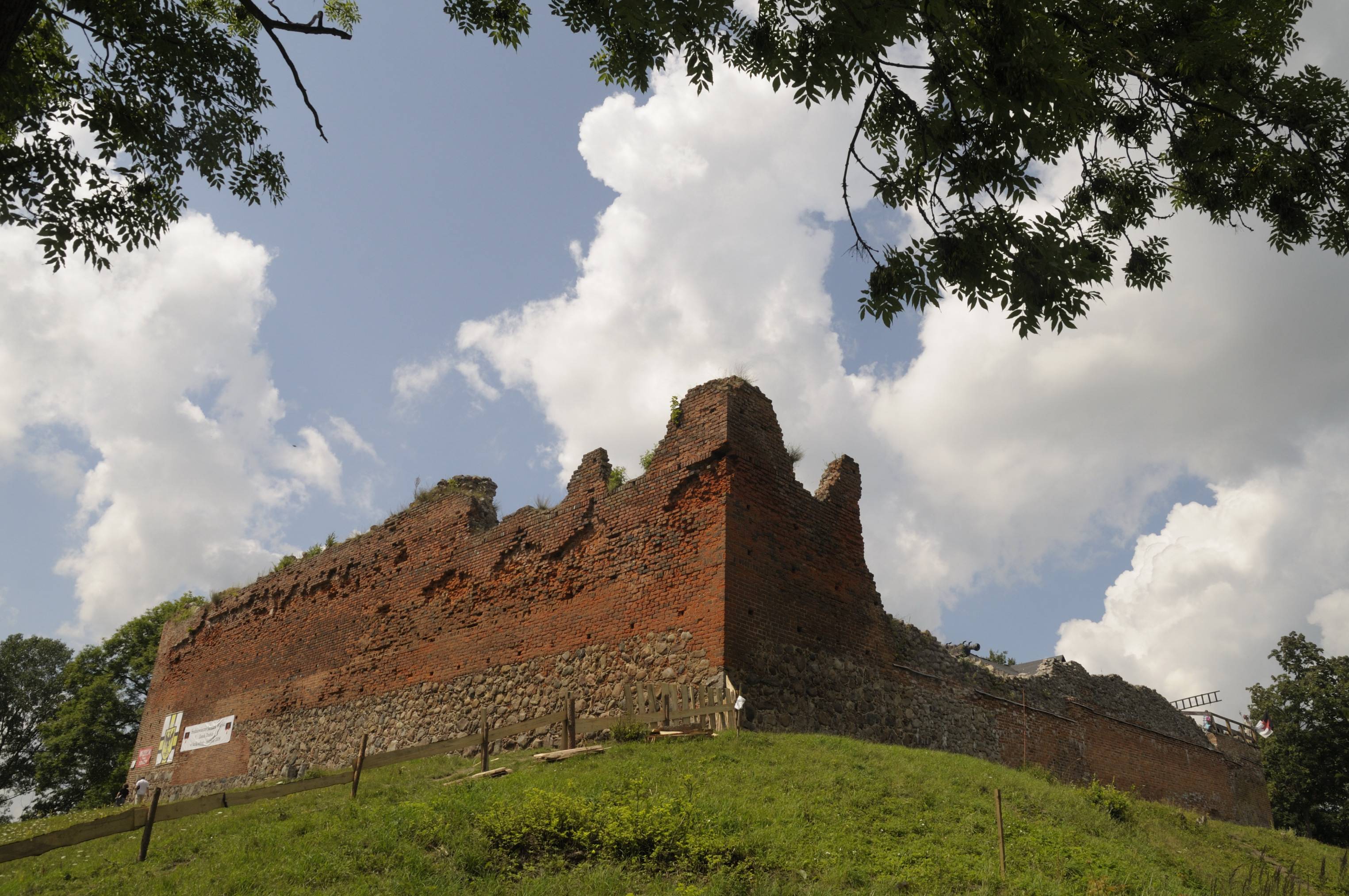
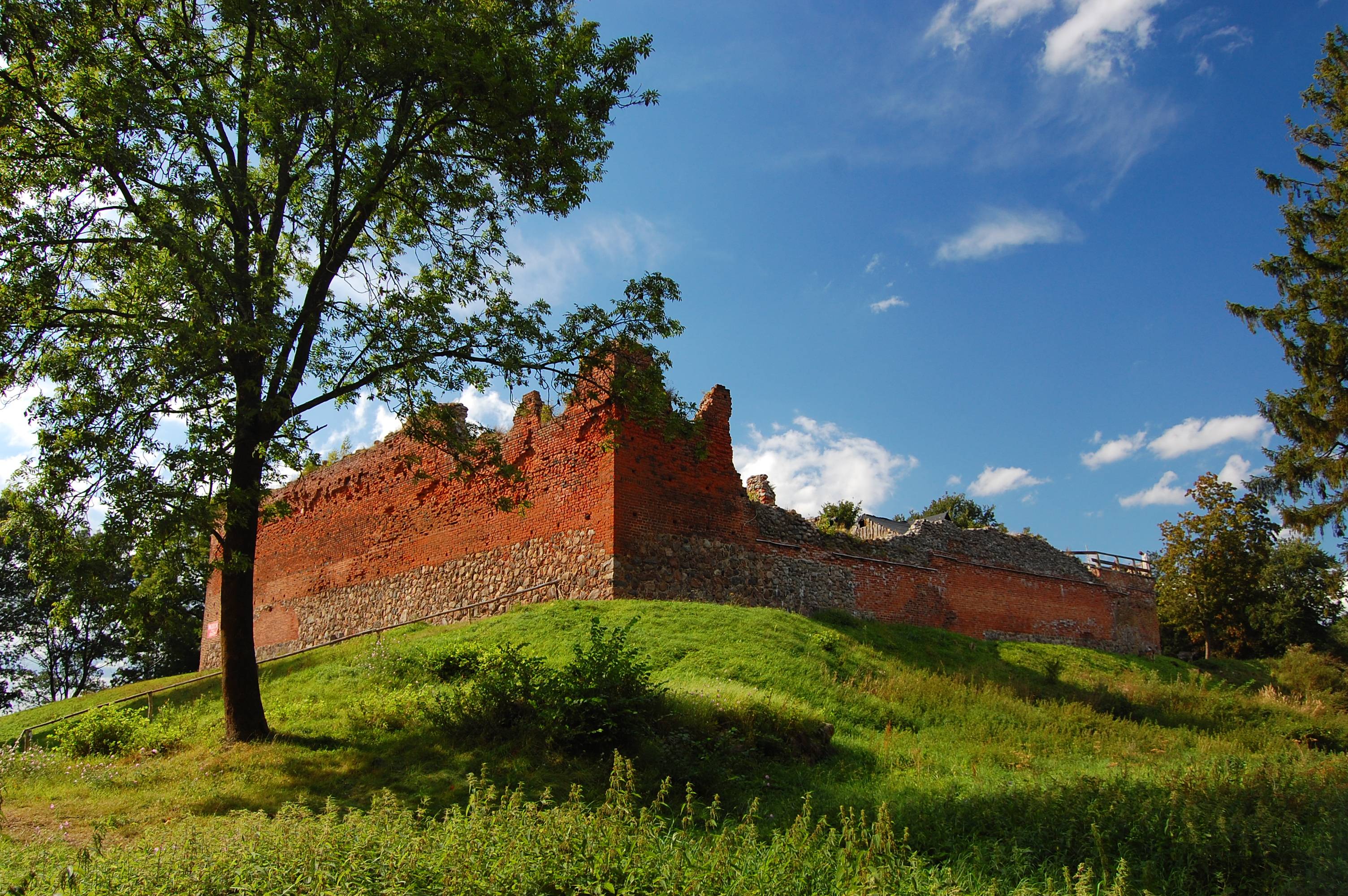
The construction of the castle is attributed to the Order of St. John. Initially, only wooden fortifications were supposed to be built, but during the years 1360-1366, works were conducted as to build stone and brick buildings. On completion of the works, the stronghold on a quadrangle plan similar to a square was erected. In the northern wall there was a gateway, which was additionally protected by the moat with a wooden drawbridge and the natural waters of Lake Drawsko and Lake Żerdno. The crown of the wall was topped with a wooden porch, from which you could shoot at an enemy during a siege. In the southern part of the castle there was a residential wing, built simultaneously with the walls. It was a two-storey building. The ground floor served as a business and residential floor. At the western wall there was a one-storey house of the starosty, but built later. A two-metre space separated it from the wall, so the house was also illuminated from the west. In the corner between the southern and western side, there was a woodshed with a basement. According to the lists of inventory, it could accommodate '20 tons of beer'. Right at the entrance gate, on the right side of the courtyard, a guardhouse was located. At the centre of the courtyard a well was dug. All these buildings of the Drahim castle are typical of defensive construction that the Hospitallers left on Polish soil. In fact, the only differentiator is the lack of a tower in the Drahim castle. Archaeologists presume that it was not built due to lack of funds. It is more likely that the other defensive qualities were sufficient to meet the expectations of the Hospitallers regarding the stronghold. The development of artillery and the art of siege forced in the sixteenth century to strengthen the defence of the castle through dump the ring of fortifications that were later modified several times.
Peripheral walls, to some degree, and a part of the walls of the economic and residential house have been preserved until present times. The castle area was utilised by a private investor. A reconstructed medieval village, an archaeological exhibition and a viewing platform have been made accessible for visitors. Food and handcraft stalls have been located in the huts.


