 Routes and trips
 Map
Map MPR - cyclist-friendly places
 POI
POI Plan your trip
 Bike counters
 Publications
 News
News Route concept
 Contact
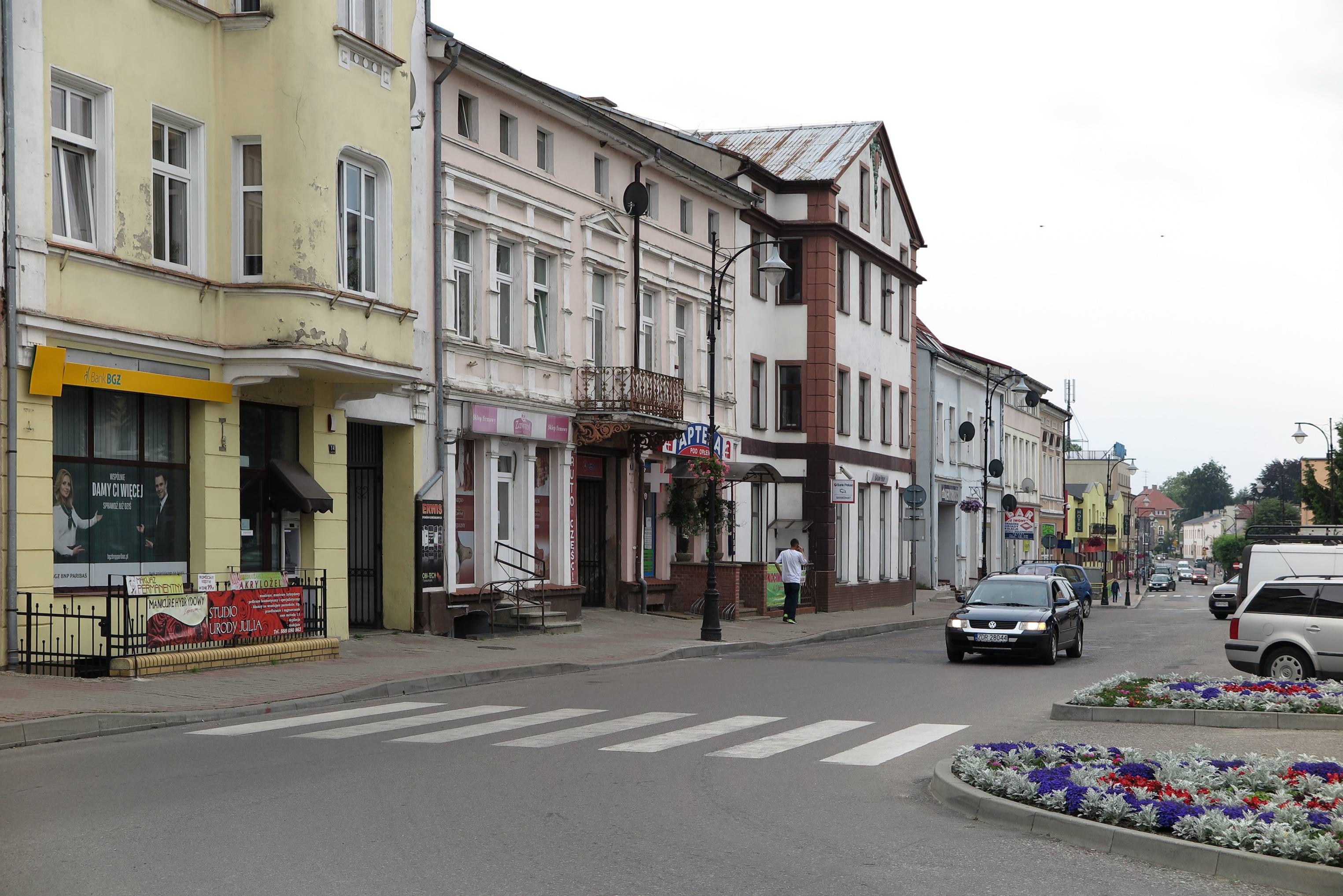
The town centre of Drawsko Pomorskie to this day has a well-preserved urban plan with a market square in the very centre. Drawsko obtained municipal rights in 1297 and was founded on a rectangular plan whose dimensions were 500 m x 370 m. The Drawa River crossed the town from the east to the west. The market square was square-shaped with a network of straight streets radiating from the square. In the vicinity of the square there was a church. Originally, the entire town was enclosed by defensive walls reinforced with an embankment system and moats. The defensive walls were 1720 m long. The oldest part of the area in question are the surroundings of the former market square (presently Konstytucji [Constitution] Square) and the late Gothic church. The town had been developing within that area until the middle of the fourteenth century. After 1350 the town had its surface area enlarged by the area between the Drawa River and the artificial channel which was dug to connect the meandering river. The total area reached around 18 ha and was surrounded by a defensive wall in the fourteenth century. Until the middle of the nineteenth century there was the old town hall on the market square. After it had been destroyed as a result of a fire, the seat of the municipal authorities was moved to the residential tenement building from the end of the eighteen century situated at 5 Ratuszowa Street. The residential tenement building survived to this day. On the market square there are still some residential buildings which date back to the turn of the nineteenth and twentieth centuries. The remaining buildings were constructed in the 1970s.
The current urban plan of the centre of Drawsko Pomorskie has not changed since the Middle Ages. The frontage generally has not changed as well. Most houses have ridge roofs, but some have a gable facing the street. The historical urban plan includes the following streets: Grunwaldzka, Zamkowa, Kilińskiego, Sikorskiego, Jagiellońska, Pocztowa, Obr. Westerplatte, Piłsudskiego, Sybiraków, 11-go Pułku Piechoty and Konstytucji Square. With the exception of a section of Sikorskiego Street, the streets are available to vehicles. Most of the streets are one-way which makes driving around town centre a bit more difficult for visitors. In 1997, during the celebrations of the 700th anniversary of obtaining municipal rights, an obelisk commemorating the event was unveiled at Konstytucji [Constitution] Square. The mayors of the twin towns – Drawsko Pomorskie and Bramstedt planted a ‘Tree of Friendship’. The historical urban plan of Drawsko Pomorskie is protected by law and was listed as a monument in 1956.


