Routes and trips
 Map
 MPR - cyclist-friendly places
 POI
 Plan your trip
 Bike counters
 Publications
 News
 Route concept
 Contact
 Berlin - Szczecin - Kołobrzeg
The Berlin-Szczecin-Kołobrzeg bike route is a new tourism product being developed by the Marshal’s Office of the West Pomeranian Voivodeship in collaboration with the Uckermark district.
Once completed, the route will have a total length of nearly 800 km, including 515 km on the Polish side and over 270 km on the German side.
The project was launched as part of the Interreg VI A Mecklenburg-Vorpommern/Brandenburg/Poland 2021–2027 program. Western Pomerania received 2.5 million euros in European funding for this initiative. In addition, as part of the European Funds for Western Pomerania, several dozen million zlotys will be allocated for the construction of new sections of this route.
A cycling route through Poland and Germany. General route.
The entire loop will be nearly 800 km long. Most of the route follows existing paths, so it is already passable today; signage will be installed by the end of 2026. The largest construction projects are planned for the section between Stepnica, Golczewo, and Gryfice, and Ryman, where an 82-kilometer-long, 2.5-meter-wide bike path is scheduled to be built.
The planned route in Germany runs as follows: Berlin-Uznam to Finowfurt; a path along the Oder-Havel Canal to Hohensaaten; the Oder-Neisse section along the Oder River to Mescherin; and the Blue Velo route all the way to Szczecin. The route on the Polish side is equally varied: Route 800 runs from Pargowo to Kołobrzeg (passing through Szczecin). Route 801, meanwhile, connects Kołobrzeg, Złocieniec, and Siekierki. On the Pargowo–Szczecin–Stepnica section, the route runs parallel to the previously mentioned Blue Velo, which is very popular among cyclists. New sections will also gradually be added between Stepnica and Skrzydłowo near Ryman. Another shared section—this time with the Old Railway Trail—can be experienced between Kołobrzeg and Złocieniec. The Old Railway Trail then connects with the Western Lake District Route, which leads to the bridge in Siekierki.
Practical Information.
The Berlin-Szczecin-Kołobrzeg route has been planned as a loop nearly 800 km long. This allows cyclists to travel from Berlin to the Polish part of the Baltic Sea and return to Berlin via two different routes. The northern section is numbered 800, while the southern section is numbered 801.
For most of its length, the route overlaps with other national and regional bike routes. As of today, there are no signs marking the Berlin-Szczecin-Kołobrzeg route on the ground, so you should follow the signage for those other routes. A schematic representation of the overlapping sections is shown below.
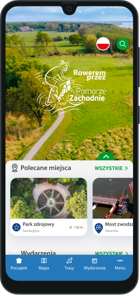
The northern route between Stepnica, Golczewo, Gryfice, and Rymań—as shown on our website and in the “Western Pomerania” app—has been routed along existing public roads with low vehicle traffic or forest roads of varying surface quality until the planned infrastructure projects are completed. Only short sections in Gryfice run along roads with heavier traffic. This section, marked with a dashed line on the map below, is recommended for more experienced cycling tourists. Currently, a section of approximately 5 km through Golczewo has been constructed.

Detailed Route Description
The entire route is divided into 14 daily stages ranging from 43 to 69 km in length (upon completion of all sections). Eleven of these stages run through Poland.
For each stage, we provide the current surface type and traffic conditions—as of October 9, 2026.
Stage 1: Berlin – Eberswalde 61 km
Surface: asphalt 48 km (79%), gravel 7 km (11%), cobblestone 3 km (7%), pavers 2 km (3%).
Traffic type: separated traffic (bike paths, pedestrian-bike paths, service roads) 32 km (53%), general traffic on public roads 19 km (31%), forest/dirt roads 10 km (16%).
Stage 2: Eberswalde – Schwedt/Oder 63 km
Surface: asphalt 56 km (87%), cobblestone 4 km (6%), concrete slabs 3 km (5%), cobblestone 0.5 km (<1%).
Traffic type: separated traffic (bike paths, shared-use paths, service roads) 25 km (39%), general traffic on public roads 38 km (61%).
Stage 3: Schwedt/Oder – Szczecin, 55 km.
The third stage leads from Schwedt/Oder in Germany to the capital of Western Pomerania. The route, approximately 55 km long, runs mainly along paved bike paths and local roads with light traffic. Following the international Oder-Neisse route, we cross the Polish-German border near the village of Mescherin.
It’s worth stopping at the observation tower in Mescherin, which offers a panoramic view of the floodplains of the Lower Oder Valley. This is one of the most ecologically valuable areas along the Polish-German border, famous for its vast wetlands and rich birdlife.
On the Polish side, you’ll see the distinctive orange markings of the Blue Velo (R3) route, whose West Pomeranian section heads toward Szczecin. Road signs also point the way to Gryfino. It’s worth considering a short detour to the famous Krzywy Las (Crooked Forest)—a unique natural monument consisting of several dozen characteristically bent pine trees, which is one of the region’s most recognizable attractions.
The main route, however, runs through Kołbaskowo and Rosówek. On this section, cyclists mostly travel on a dedicated bike path running alongside the main road leading to Szczecin. Due to ongoing construction work on the Szczecin Western Bypass, cyclists should exercise extreme caution in areas where work is in progress.
We enter Szczecin from the south, gradually approaching the city center. Along the way, you can admire Szczecin’s most important landmarks and attractions, such as the Main Train Station, the Port Gate, the Mieczysław Karłowicz Philharmonic, and the impressive Chrobry Embankment with views of the Oder River and the port.
Szczecin is one of the most important hubs for cycling tourism in Poland. Four long-distance cycling routes intersect in the city center: the BSK, Blue Velo, Western Lake District Route, and the Route Around the Szczecin Lagoon. These routes run together for approximately 10 kilometers along the Międzyodrze section.
Stage 4: Szczecin – Goleniów (Modrzewie) 43 km (49 km to the center of Goleniów)
Surface: asphalt 15 km (32%), gravel 30 km (66%), concrete slabs 0.5 km (1%).
Traffic type: separated traffic (bike paths, pedestrian-bike paths, service roads) 43 km (95%), general traffic on public roads 2 km (5%).
Stage 5: Goleniów (Modrzewie) – Gryfice 67 km
Surface: asphalt 39 km (55%), aggregate 20 km (29%), unpaved 7 km (10%), cobblestone 4 km (5%).
Traffic type: separated traffic (bike paths, pedestrian-bike paths, service roads) 15 km (21%), general traffic on public roads 34 km (48%), forest/dirt roads 22 km (31%).
Stage 6: Gryfice – Kołobrzeg (coast) 68 km
Surface: asphalt 46 km (74%), cobblestone 7 km (11%), gravel 8 km (13%), concrete slabs 1 km (2%).
Traffic type: separated traffic (bike paths, pedestrian-bike paths, service roads) 42 km (68%), general traffic on public roads 20 km (32%).
Stage 7: Kołobrzeg – Białogard 49 km
Surface: asphalt 39 km (80%), cobblestone 9 km (18%), gravel and concrete slabs <1%.
Traffic type: separated traffic (bike paths, pedestrian-bike paths, service roads) 45 km (93%), general traffic 3 km (6%), forest/dirt roads 0.5 km (1%).
Stage 8: Białogard – Złocieniec 65 km
Surface: asphalt 64 km (98%), cobblestone 1 km (2%).
Traffic type: separated traffic (bike paths, pedestrian-bike paths, service roads) 35 km (54%), general traffic 31 km (46%).
Stage 9: Złocieniec – Ińsko 45 km
Surface: asphalt 34 km (86%), gravel 3 km (7%), dirt 3 km (7%).
Traffic type: separated traffic (bike paths, pedestrian-bike paths, service roads) 16 km (35%), general traffic 18 km (41%), forest/field roads 11 km (24%).
Stage 10: Ińsko – Choszczno 44 km
Surface: asphalt 39 km (89%), gravel 3 km (7%), concrete slabs 2 km (4%).
Traffic type: separated traffic (bike paths, pedestrian-bike paths, service roads) 21 km (48%), general traffic 21 km (48%), forest/dirt roads 2 km (4%).
Stage 11: Choszczno – Myślibórz 60 km
Surface: asphalt 58 km (95%), aggregate 2 km (4%), cobblestone 0.5 km (1%).
Traffic type: separated traffic (bike paths, pedestrian-bike paths, service roads) 48 km (80%), general traffic 11 km (19%), forest/dirt roads 0.5 km (1%).
Stage 12: Myślibórz – Moryń (Przyjezierze) 48 km (50 km to the center of Moryń)
Surface: asphalt 48 km (99%).
Traffic type: separated traffic (bike paths, pedestrian-bike paths, service roads) 35 km (73%), general traffic 13 km (27%).
Stage 13: Moryń – Strausberg 59 km
Surface: asphalt 55 km (93%), cobblestone 2 km (3%), pavers 1 km (2%), gravel 1 km (2%).
Traffic type: separated traffic (bike lanes, shared-use paths, service roads) 42 km (71%), general traffic 14 km (24%), forest/dirt roads 4 km (6%).
Stage 14: Strausberg – Berlin 67 km
Surface: asphalt 44 km (66%), cobblestone 20 km (30%), gravel 2 km (3%), concrete slabs 1 km (1%).
Traffic type: separated traffic (bike paths, pedestrian-bike paths, service roads) 53 km (79%), general traffic 11 km (16%), forest/dirt roads 3 km (5%).
Funding is provided under the “Berlin–Szczecin–Kołobrzeg Bicycle Route” project implemented by the Marshal’s Office of the West Pomeranian Voivodeship in cooperation with the Uckermark District as part of the Interreg VI A Mecklenburg–Western Pomerania/Brandenburg/Poland 2021–2027 program.
 marked
 unmarked
 Asphalt / concrete cube
 Gravel
 Asphalt / concrete cube
 Gravel
 Currently designed / under construction
 Heavy car traffic
 Rough / dirt road