 Routes and trips
 Map
Map MPR - cyclist-friendly places
 POI
POI Plan your trip
 Bike counters
 Publications
 News
News Route concept
 Contact
Stage V: Gryfino – Trzcińsko-Zdrój [43 km]
Most of the route follows old railway embankments, partly also roads with little traffic or dedicated bicycle infrastructure or forest roads. The route is mostly asphalt. Short sections, mainly forest sections, are made of aggregate, some of concrete blocks.
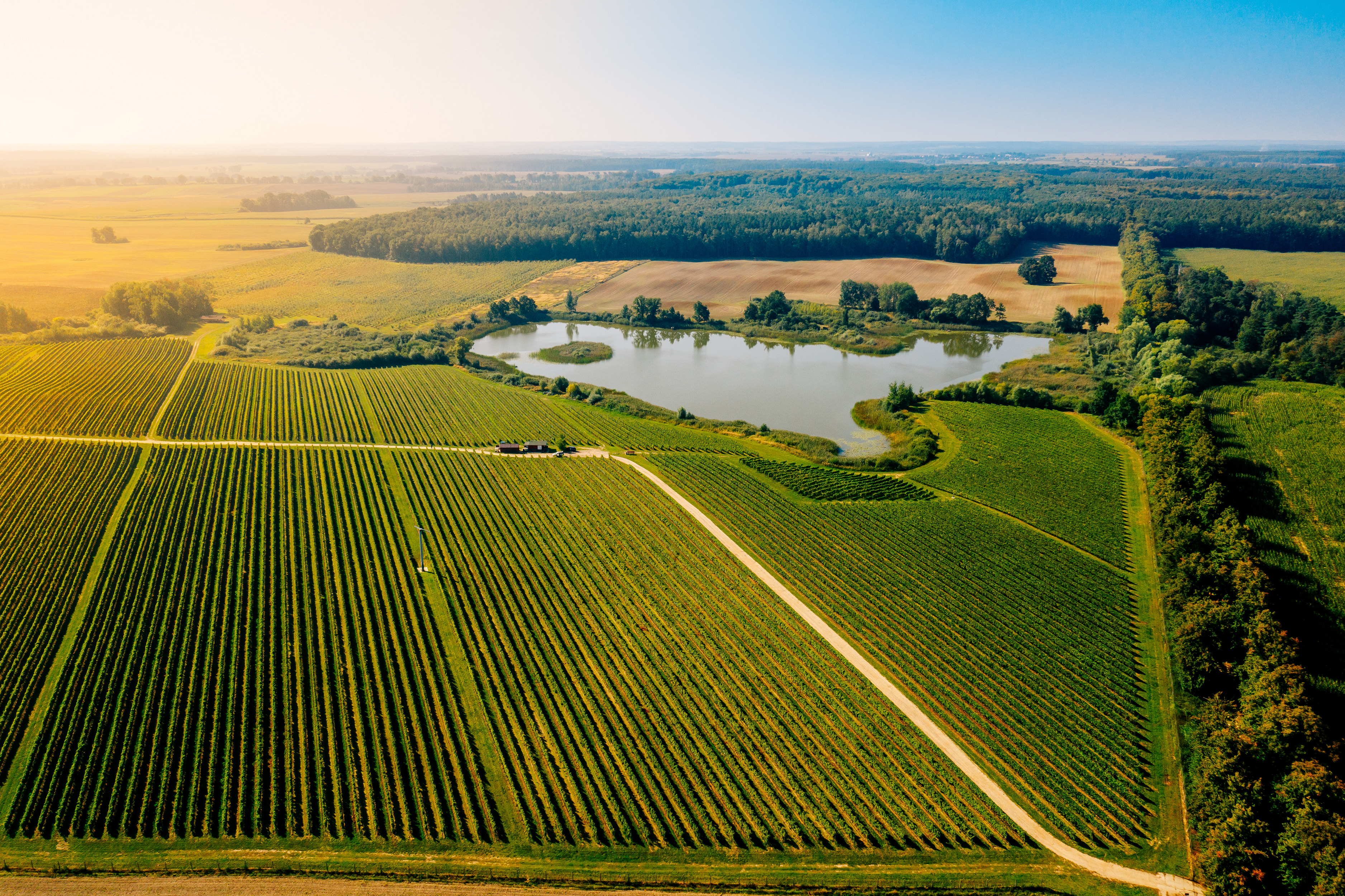
In Szczawno, behind Gryfino, we enter a bicycle path on the embankment of the former Gryfino-Swobnica railway line, riding along the tributary of the Oder River – the Tywa River and trough lakes, such as Lake Wełtyńskie. Above the Tywa, you can find the remains of damming devices, which once powered mills and now serve to supply water to nearby ponds. After Lubanów, on the left, you can see the ruins of a Dutch windmill in Otoki in the distance. The building was erected at the end of the 19th century and operated until the 1960s. A few kilometers further on, we imperceptibly enter "Szczecin's Tuscany," the area around the Turnau vineyard in Baniewice. The hilly landscape guarantees sunny southern slopes, planted mainly with Solaris and Johanniter grapes, as well as Riesling, Hibernal, Seyval Blanc, Rondo, Regent, and Cabernet. The Turnau family, including artist Grzegorz, has only been growing grapes here since 2010, but the local wines have already gained considerable renown. Chardonnay 2020 was even selected as the best white wine in Poland in the Polskie Korki 2022 competition, the most prestigious wine competition in the country.
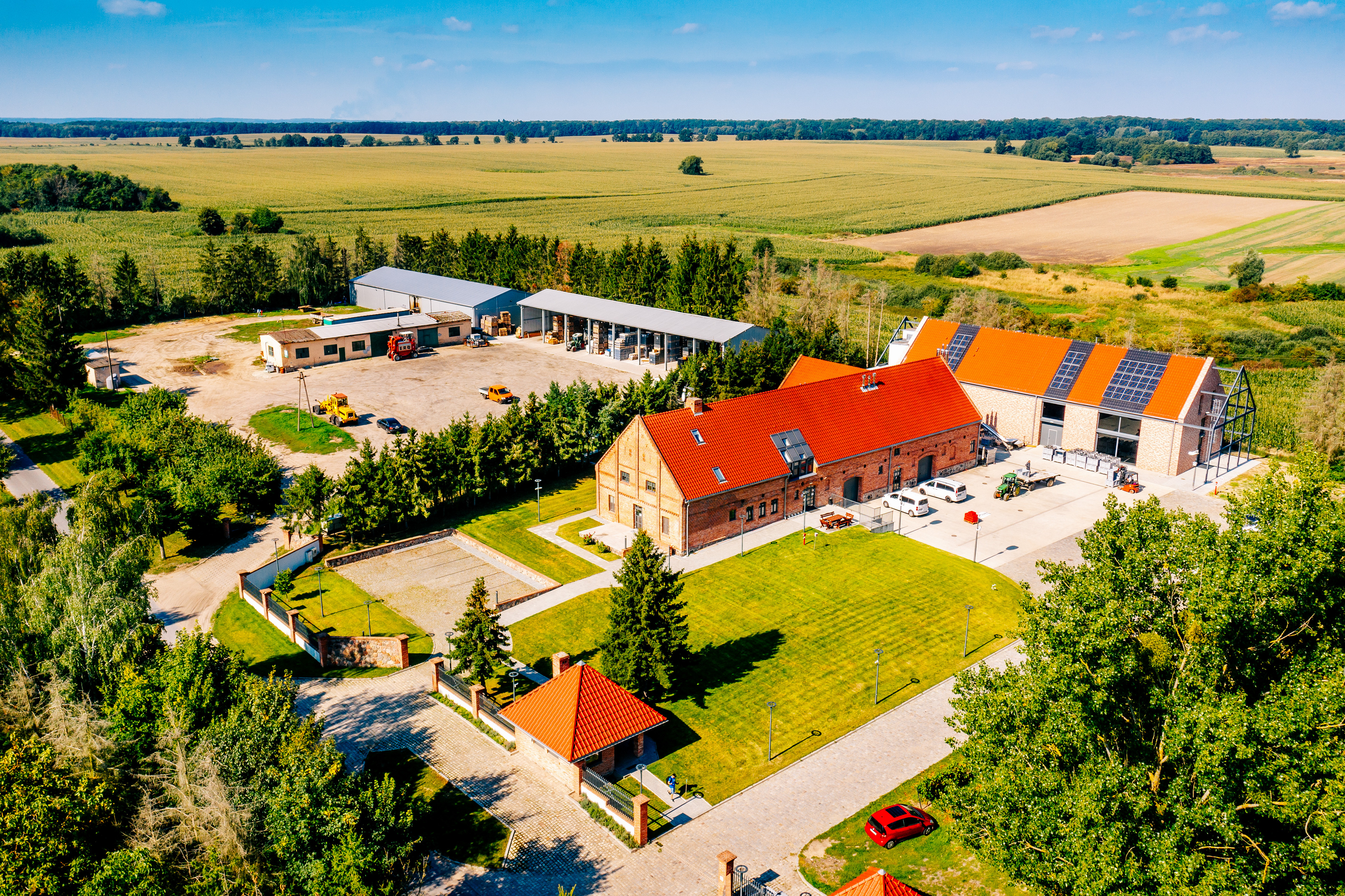
The vineyard is open to visitors, who can also taste the wines and cheeses produced here. A three-hour tour must be booked in advance, but you can also drop in spontaneously. The 19th-century winery building houses a company shop where you can buy a bottle of fine local wine. Wine is difficult to transport in panniers (especially since there is a somewhat bumpy gravel road between Swobnica and Strzeszów), so you may want to consider staying overnight at the winery.
It is a pity that (for now?) it is not possible to sleep in the castle in Swobnica, as it would certainly be one of the biggest attractions in the region. From the first half of the 13th century, Swobnica, located behind Lake Długie, together with the surrounding areas, belonged to the Knights Templar, who had their main headquarters in the village of Rurka. After the dissolution of the order in 1312, the Templars' property was taken over by the Knights Hospitaller, who moved their headquarters to nearby Swobnica. The building with a 35-meter tower was completed at the end of the 14th century. It survived the war without major damage and then served as the headquarters of the state-owned farm, which created a granary in the castle. The worst period was the 1990s, when the building was sold to private owners and quickly fell into disrepair. The municipality of Banie regained the monument only in 2011, after the collapse of the oldest wing. In 2013, the renovation of the tower was completed, which is now the only part of the building open to visitors. In 2021, the castle was put up for sale. In nearby Rurka, there are no traces of the Templar fortress, but the order's chapel from 1248 has been preserved, resembling English Romanesque buildings in shape: the sandstone chapel in Aston Eyre near Birmingham or the single-nave stone church in Goodnestone in the county of Kent.
Transport: the PKP railway station is located in Gryfino ( on the Szczecin-Kostrzyn line). Connections are operated by POLREGIO and Intercity. The timetable can be found at https://portalpasazera.pl
Road surface: asphalt 75%, aggregate 20%, cobblestones 4%, paving stones 1%.
Type of traffic: bicycle paths 64%, general traffic 19%, forest/field roads 17%.


