 Routes and trips
 Map
Map MPR - cyclist-friendly places
 POI
POI Plan your trip
 Bike counters
 Publications
 News
News Route concept
 Contact
Stage IV: Świnoujście/Ahlbeck – Anklam [53 km]
The route alternates between cycle paths and local roads with little traffic. Almost the entire section runs on asphalt and concrete surfaces. It is also possible to shorten the route by taking the Kamp – Karnin bicycle ferry.
Trail marking: good, shared with the Oder-Neiße-Radweg (D-12) trail, Stettiner Haff-Rundweg signs appear sporadically.
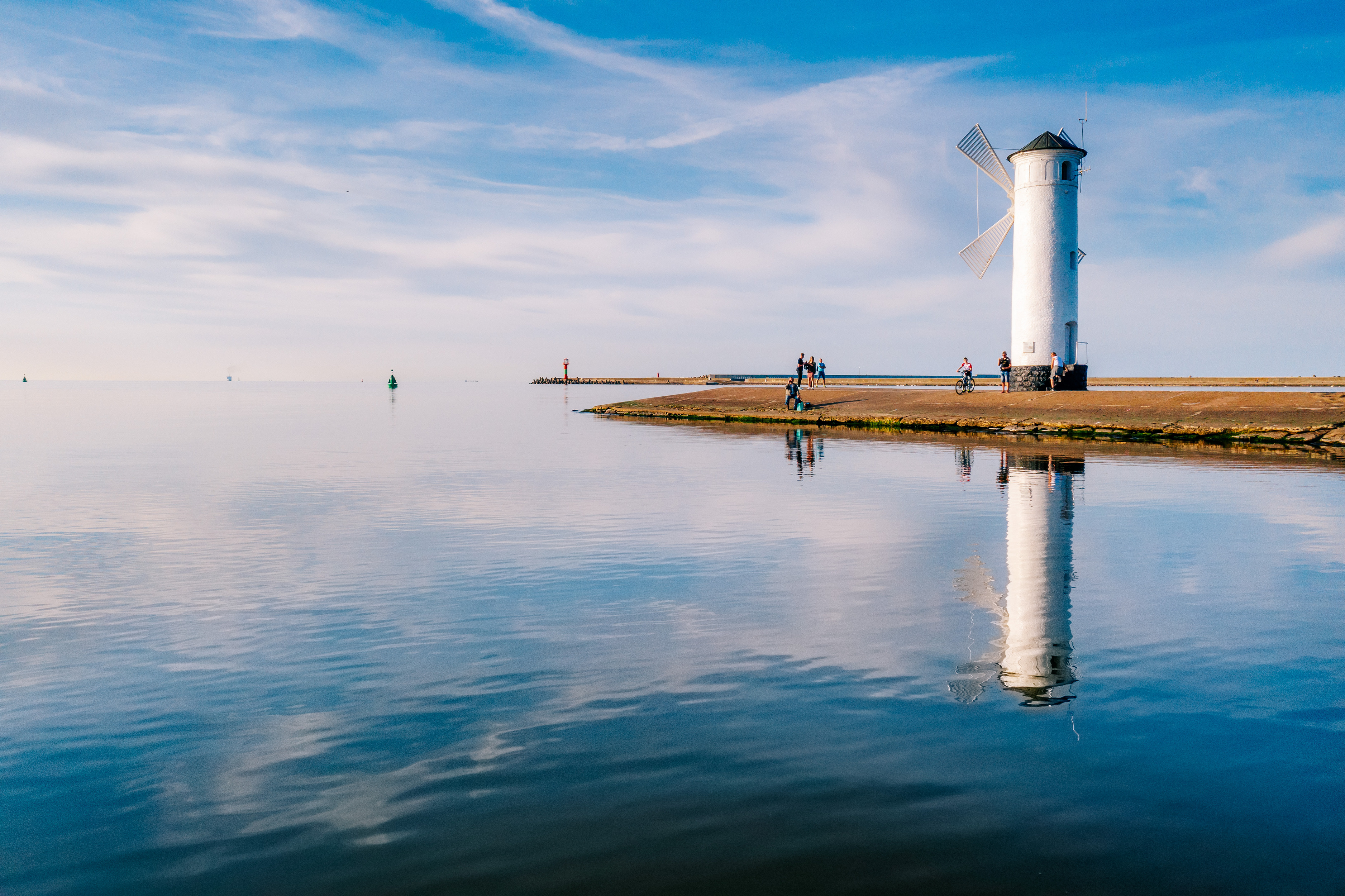
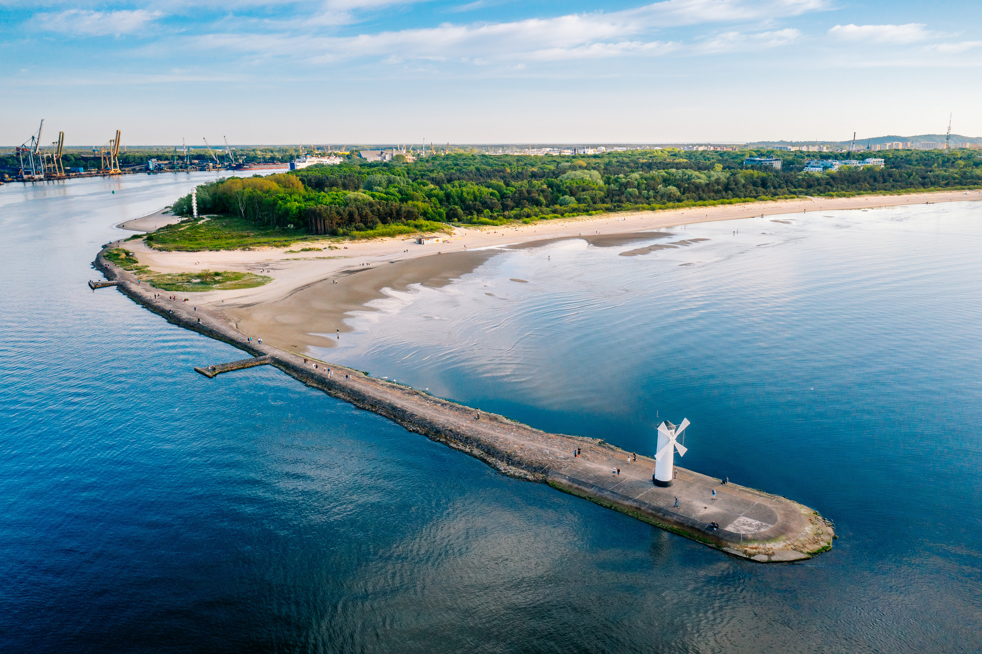
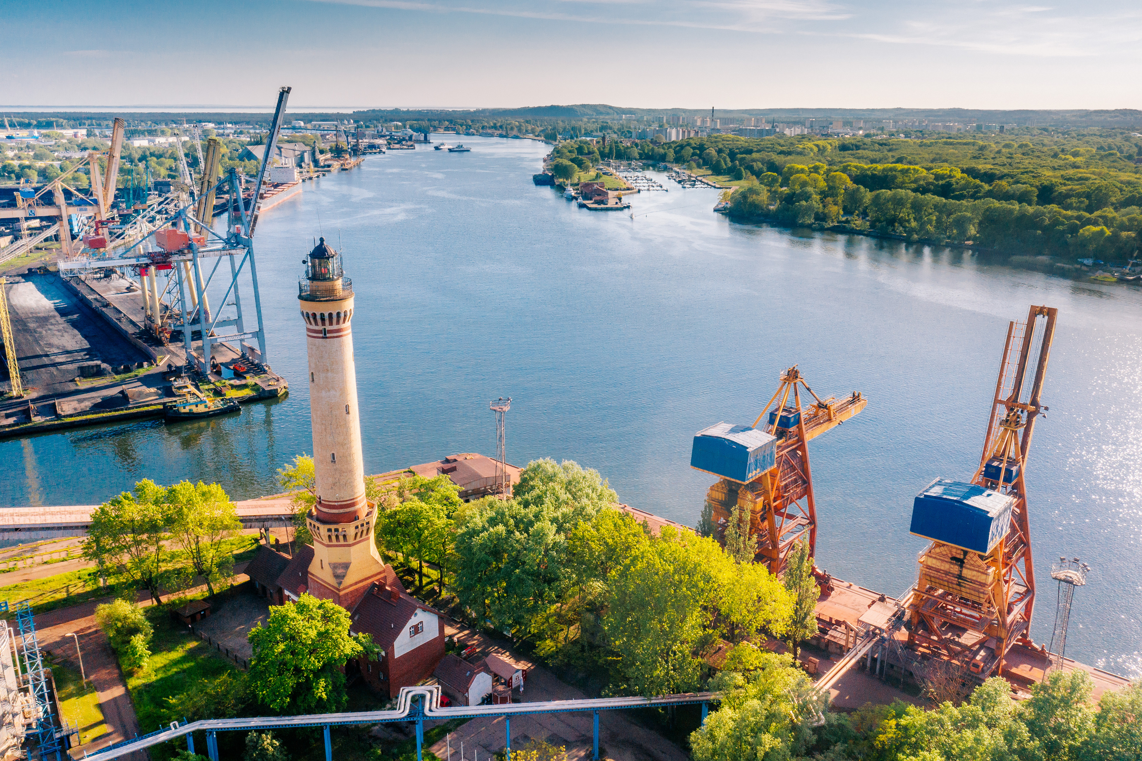
Świnoujście offers a wide range of attractions, which we also mention in the descriptions of the Velo Baltica and Blue Velo trails. Located on 44 islands, the city was a fortress during Prussian times, as evidenced by numerous military attractions, including Fort Gerhard on Uznam, one of the best-preserved 19th-century Prussian coastal forts in Europe. Right next to it stands the tallest lighthouse in Poland. It is also the tallest brick building of its kind in the world, so it is worth climbing to the top to see the view of the city, the forts, the ferries from Sweden entering the port, and the expanding gas port – a pillar of Poland's energy security. On the other side of the Świna River, you can see another fort, this time Anioła, and a few steps further - Fort Zachodni. The most picturesque attraction of the city is Stawa Młyny, a navigation facility with a fanciful windmill shape. It is one of the most photographed places on the Polish coast. From here, we can drive along the Promenada Zdrowia (Health Promenade), and then through the forest to the symbolic gate on the border with Germany, or along Wojska Polskiego Street straight to the border crossing, which is marked by posts in the national colors of both countries.
Passing by the gate, we can continue our journey along a comfortable walking and cycling path through the forest, which will lead us straight to the pier in Ahlbeck. It is worth going a few extra kilometers to see the next two of the three Imperial Resorts: Ahlbeck, Heringsdorf, and Bansin with their beautiful buildings from the turn of the 19th and 20th centuries. Even if, by some miracle, we "sleep through" the border, we will immediately realize that we are no longer in Poland. If, on the other hand, you stick to the trail, after less than 20 kilometers of riding through undulating terrain, you will pass the DDR Museum Dargen / Usedom - the equivalent of our PRL museums. It houses an impressive collection of exhibits from the GDR era, including numerous cars, buses, and agricultural machinery. It is worth a visit even though there are no descriptions in English.
You could say that we are now on a technology trail, because the next museum on the route is "Traktoren Welt," or "World of Tractors." I think the name says it all. After Usedom, we head for what is probably the most spectacular technical monument on the Lagoon, and certainly on the German side. The mighty, once drawbridge span of the former railway bridge stands alone in the middle of the strait. Until the end of World War II, it was part of the bridge on the Berlin-Świnoujście route, blown up by the Wehrmacht in the last days of the war. The Soviet army provisionally rebuilt the bridge to use the railway line to transport everything of value, but later the unused line fell into disrepair, and all that remained of the great bridge was the central span, raised for all time to a height of 28 meters. There are plans to rebuild the line, which would mean that a new bridge would be built nearby. The structure can only be viewed up close from the water – and there is a way to do that. We can take a ferry to the village of Kamp, saving ourselves a 33-kilometer drive. The crossing takes 10 minutes and was created with cyclists in mind. It is operated by a new vessel, the "Antonia von Kamp," which can carry 20 bicycles. The ferry departs every hour on the hour from 10 a.m. to 5 p.m. (until October 17).
If we are not in a hurry, it is worth visiting Anklam, as it is one of the most beautiful sections of the trail. We leave the island of Usedom via the Zecheriner Brücke, a drawbridge dating from 1931. Then the bike path runs along the road, passing mysterious floodplains with a submerged forest, which can be viewed from a comfortable observation tower. This is how we reach Anklam, crossing the Piana River via a foot and bike bridge.
Transport: Deutsche Bahn railway stations are located in Świnoujście, Ahlbeck (connections on the island of Usedom and to Züssow, where further connections are possible) and Anklam (connections to Stralsund or Berlin, for example). From Kamminke, you can take a ferry to Ueckermünde. In 2021, the Kamp-Karin ferry connection was resumed. There is an airport in Heringsdorf near Świnoujście.
Surface: asphalt 84%, aggregate 2%, cobblestones 12%, slabs 2%.
Type of traffic: bicycle paths 56%, general traffic 40%, forest/field roads 4%.


