Routes and trips
 Map
Map MPR - cyclist-friendly places
 POI
POI Plan your trip
 Bike counters
 Publications
 News
News Route concept
 Contact
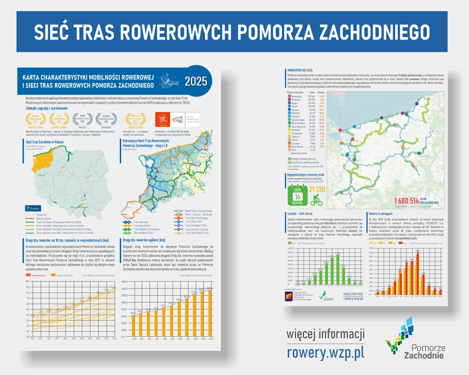
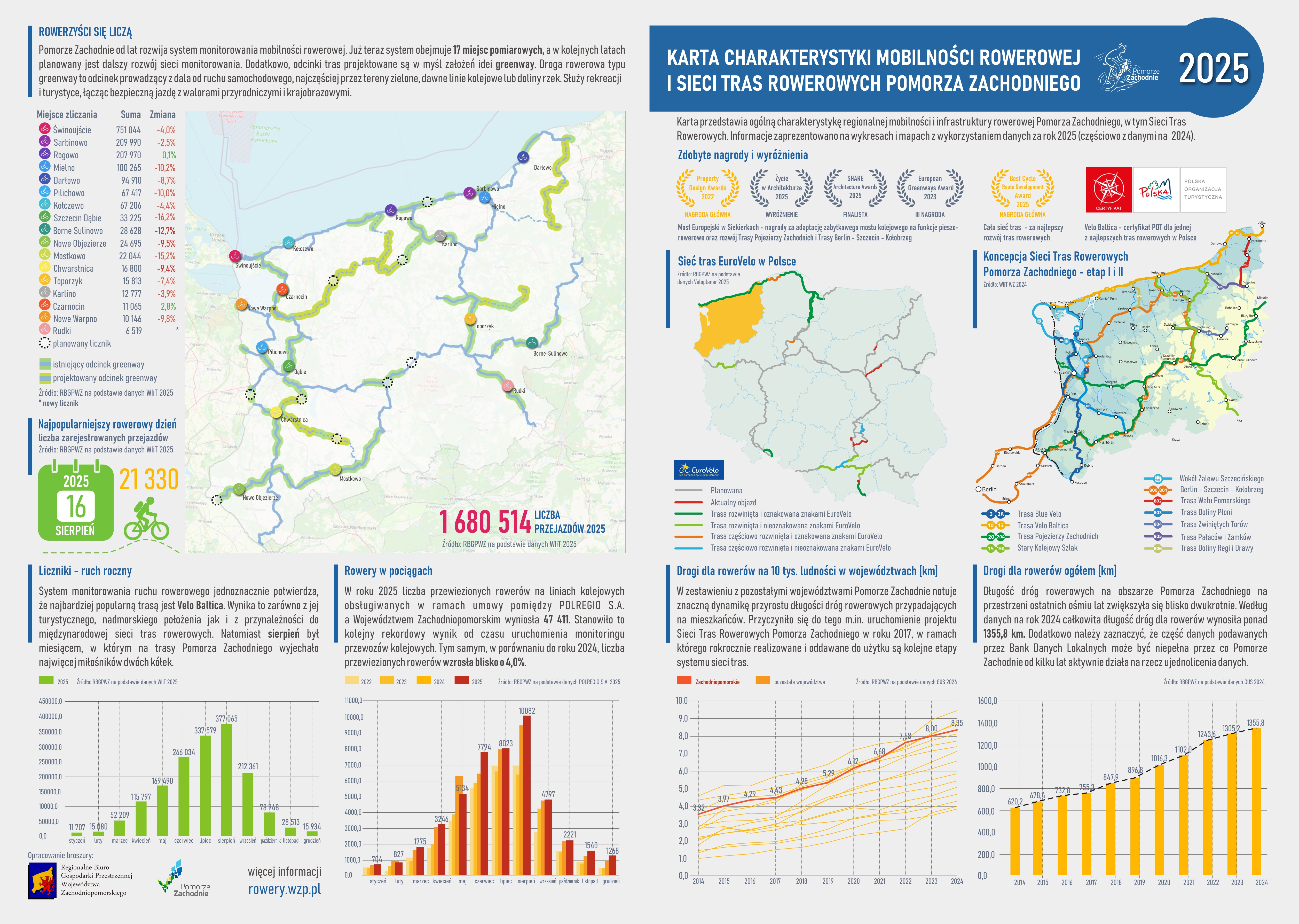
You can print the card yourself (PDF file at the bottom of the page) or receive it at our event,the 3rd Polish-German Cycling Tourism Days. It is also available in English.
The card begins with a presentation of the awards and distinctions received. In 2025, the European Bridge in Siekierki won an award in the "Life in Architecture" competition and was a finalist in the "SHARE Architecture Awards." The European Cyclists' Federation (ECF) also awarded Western Pomerania the Best Cycle Route Development Award for the best development of cycling routes. But that's not all: the EuroVelo & Cycling Tourism Awardswere presented for the first time and went to Poland, which is an important distinction for the region.
Next, a map of the EuroVelo route network in Poland is presented, prepared on the initiative of the National EuroVelo Coordination Center (NECC) and VeloPlanner – Velomapa. Six EuroVelo routes run through Poland, two of which – EV10 (Baltic Sea Cycle Route) and EV13 (Iron Curtain Trail) – run through Western Pomerania and are known locally as VeloBaltica.
Next to it, the concept of a network of bicycle routes is presented – stages I and II of the four planned stages.
The two charts at the bottom of the first page, based on data from the Central Statistical Office, show:
- the increase in the length of bicycle paths per 10,000 inhabitants (broken down by province),
- the absolute length of bicycle paths in the West Pomeranian Province.
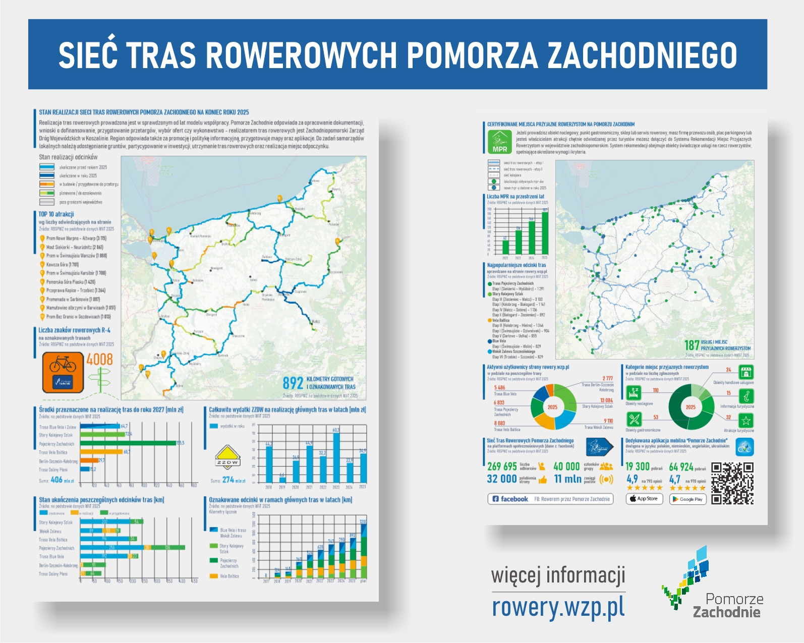
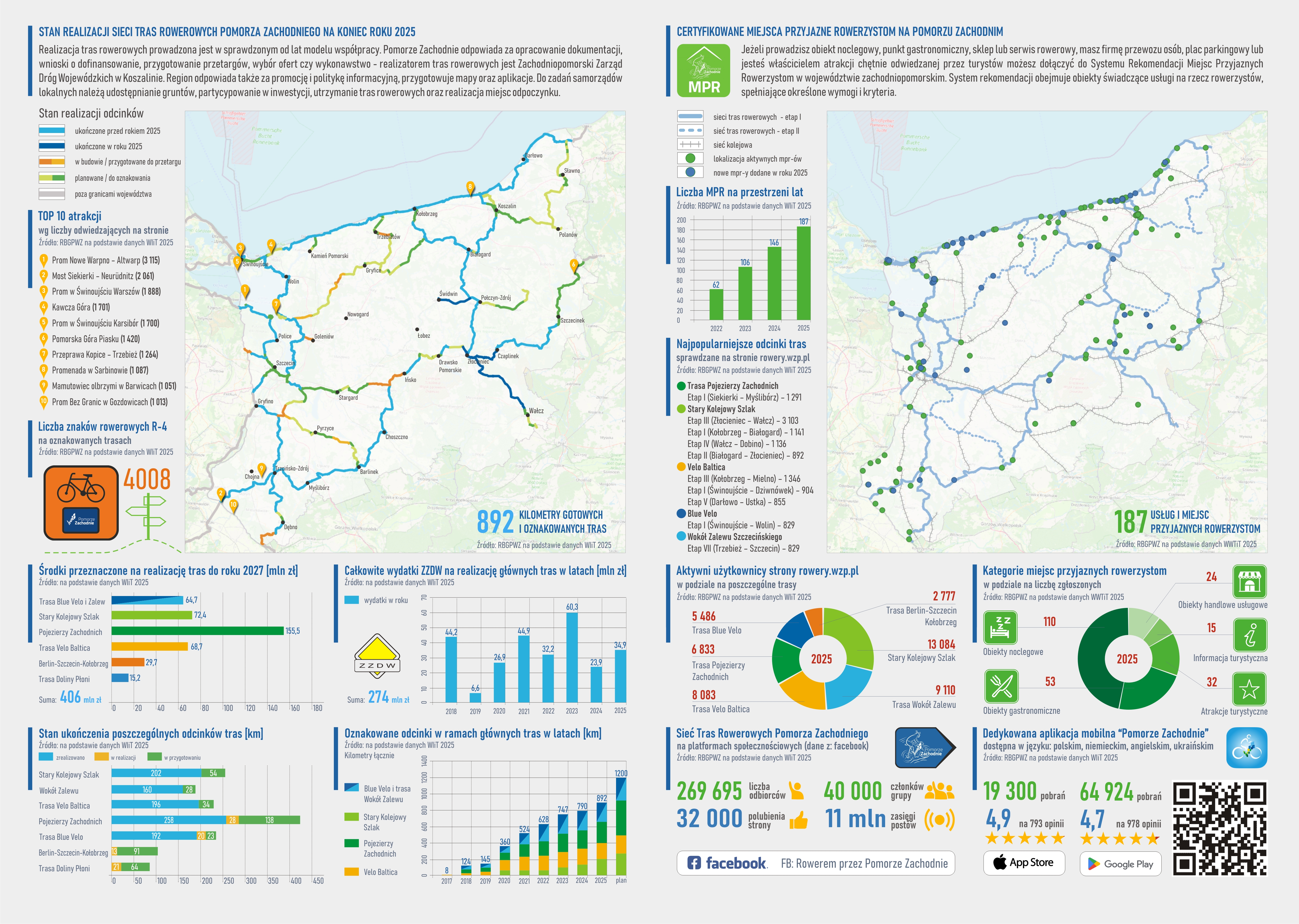
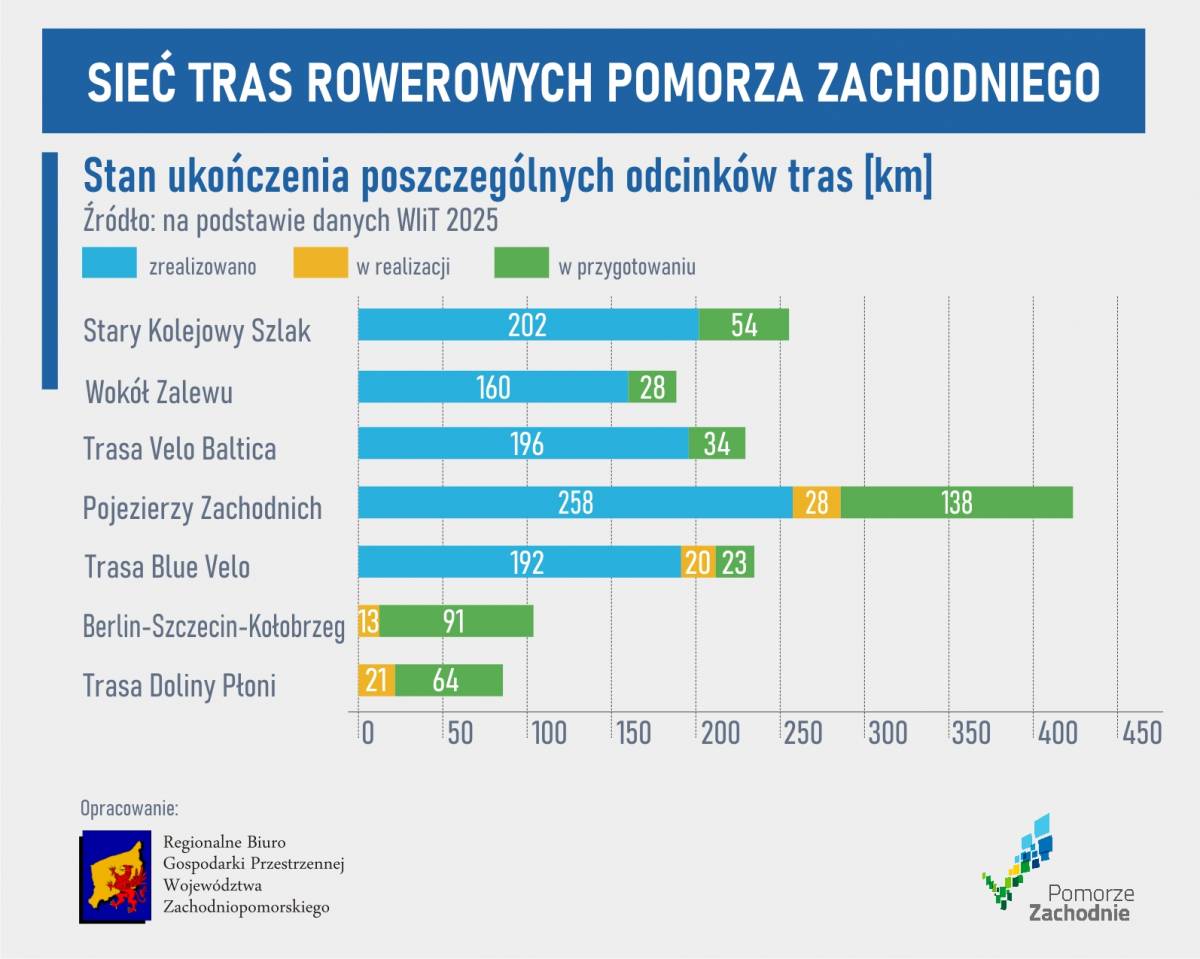
The next page is devoted to the development of the bicycle route network. The total length of the sections marked in 2025 was 104 km. The map also shows the locations where preparations for tenders are underway. We have described this in detail in a separate article summarizing bicycle investments in 2025.
In addition to the status of implementation, the map also shows the most frequently searched attractions on the website according to the number of visitors. Ferry crossings definitely stand out, dominating the list.
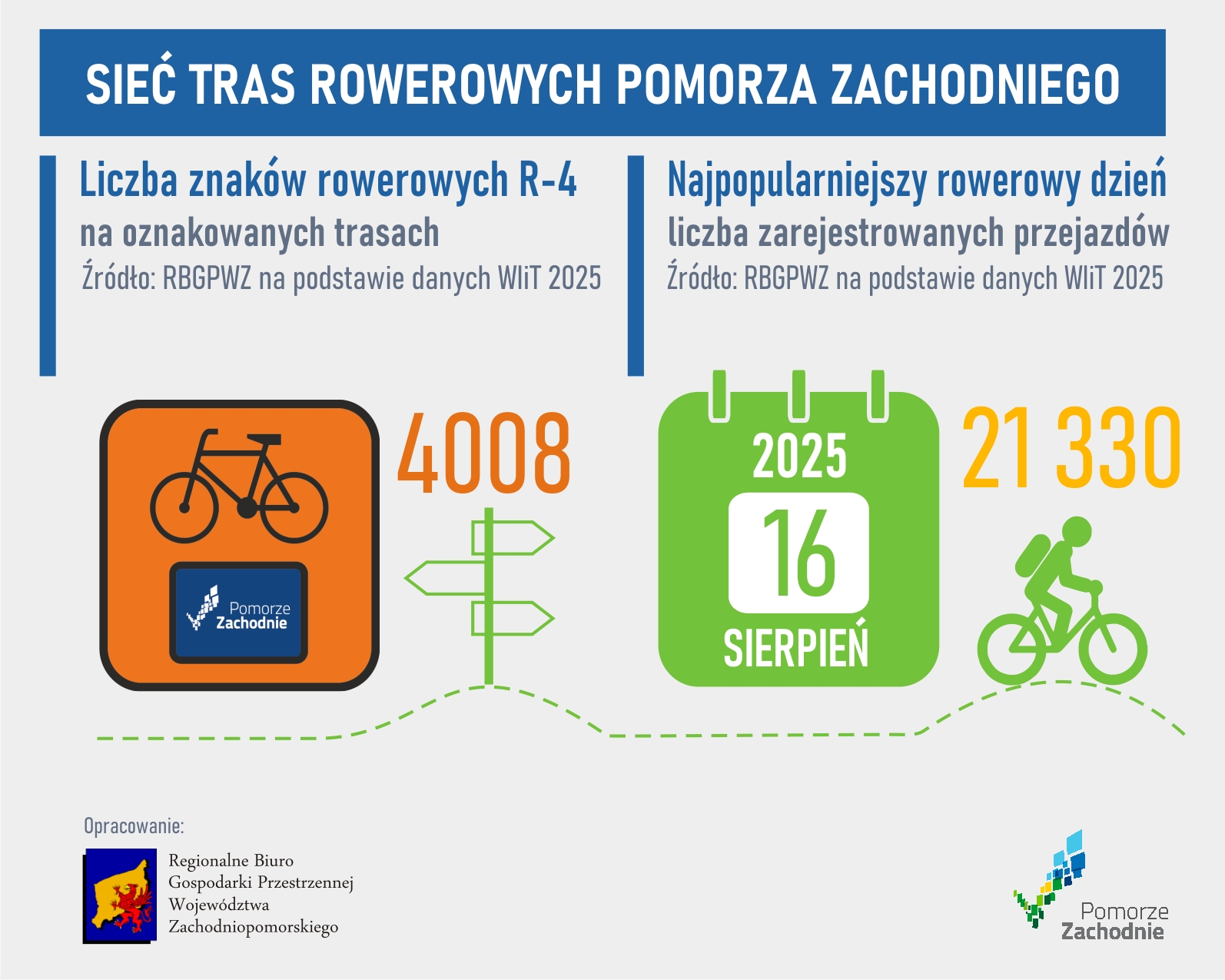
As a curiosity, we have provided the number of R-4 signs located on the routes – there are 4,008 of them. Accurate signage is a priority for us, as it affects the comfort and safety of cycling in the region.

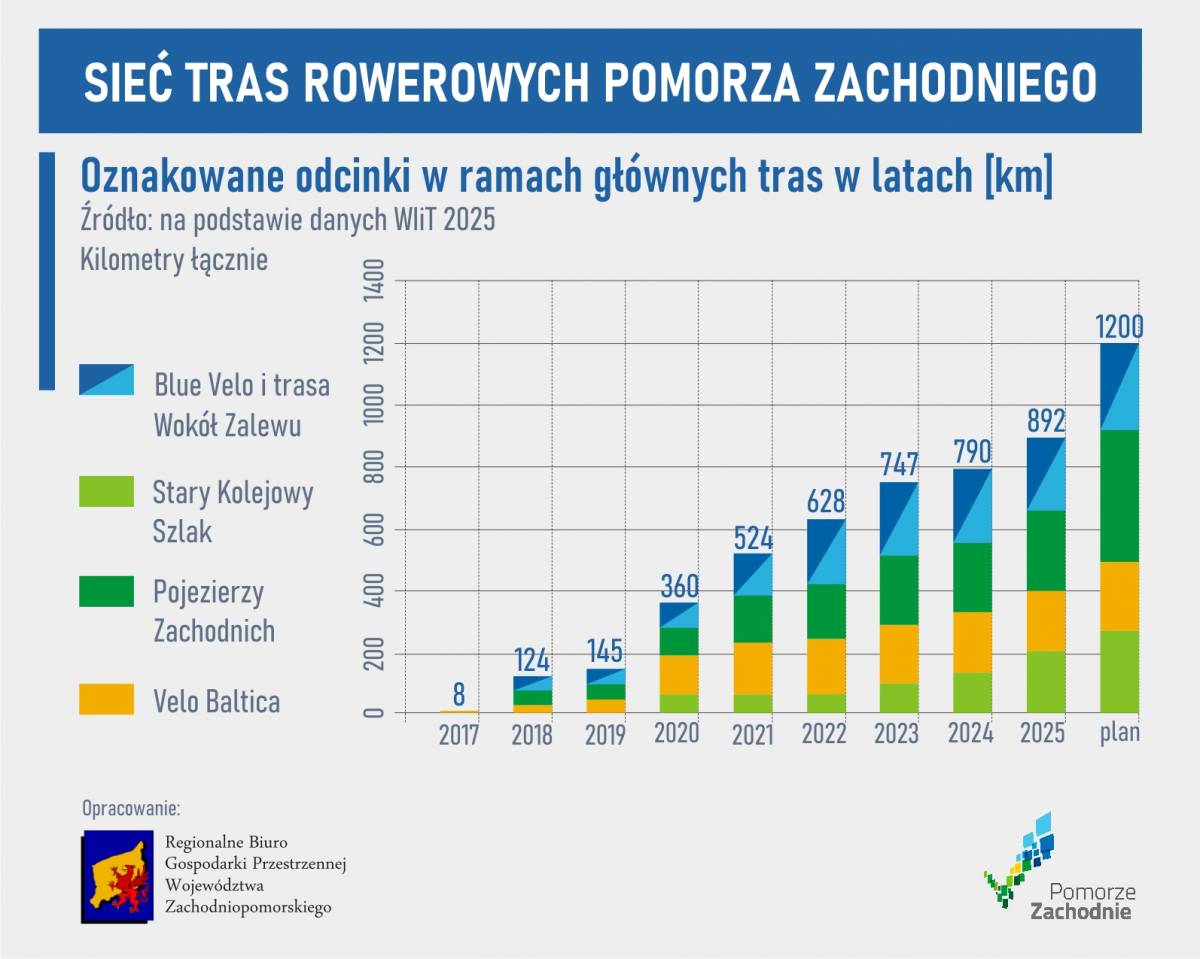
The charts at the bottom of the page show the expenses and the degree of investment implementation. It can be seen that some of the routes of the second stage – including Dolina Płoni and Berlin–Szczecin–Kołobrzeg – have entered a key phase of development. The total amount allocated for the development of routes until 2027 is PLN 406 million. Currently, 892 km of routes are marked, although over 1,100 km remain ready for cycling.
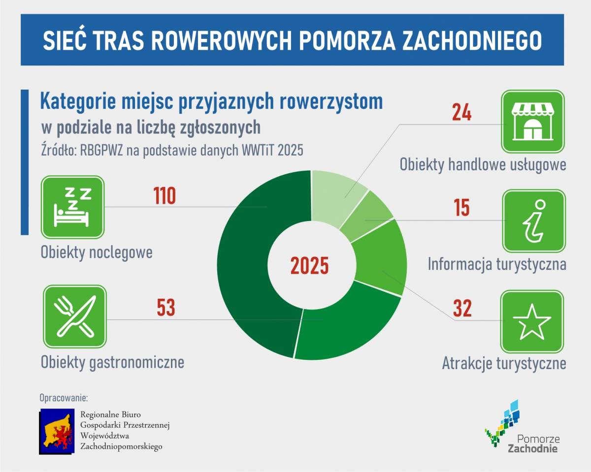
Another large map shows the Cyclist-Friendly Places (MPR) system. After last year's recruitment, cyclists can use 187 MPRs, mainly accommodation facilities offering secure bicycle storage.
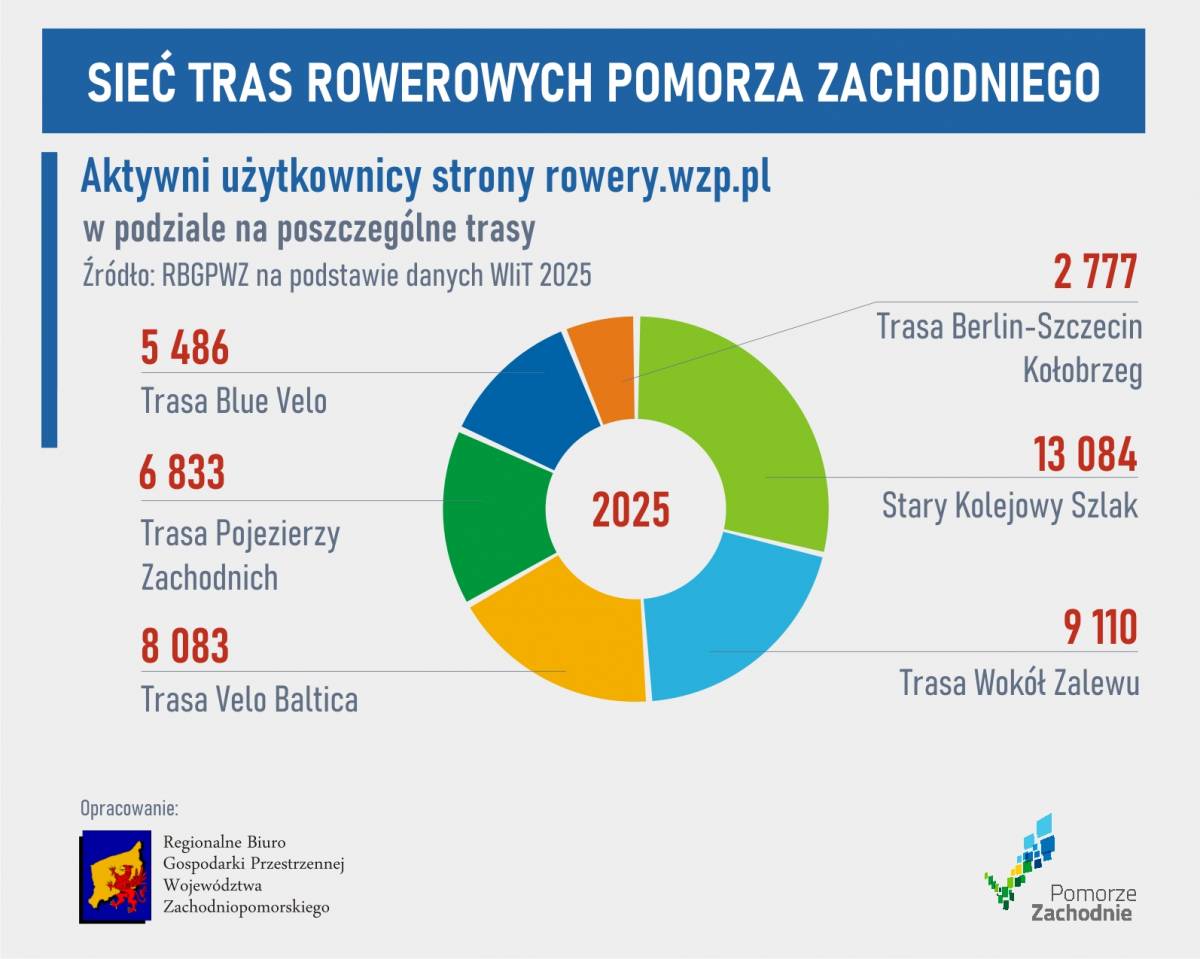
Next to it is a summary of the number of website users broken down by routes and stages. Last year, the Old Railway Trail was the most popular, especially the newly opened section between Złocieniec and Wałcz.
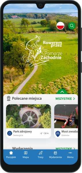
There is also information about our social media – the number of likes for the Cycling through Western Pomeraniapage exceeded 32,000, and the posts were viewed 11 million times. We would like to thank everyone for this result. Next to it is a summary of downloads of the "Western Pomerania" mobile app, which was downloaded about 85,000 times.
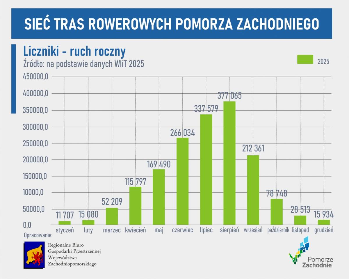
On the last page, we show that cyclists matter – we present data from counters. A detailed summary can be found in the article "Cycling traffic in 2025: the most popular routes in Western Pomerania." The busiest day of 2025 was August 16, when the counters recorded 21,330 trips. A new feature is the map of greenway corridors – sections away from car traffic, on separate bicycle paths.
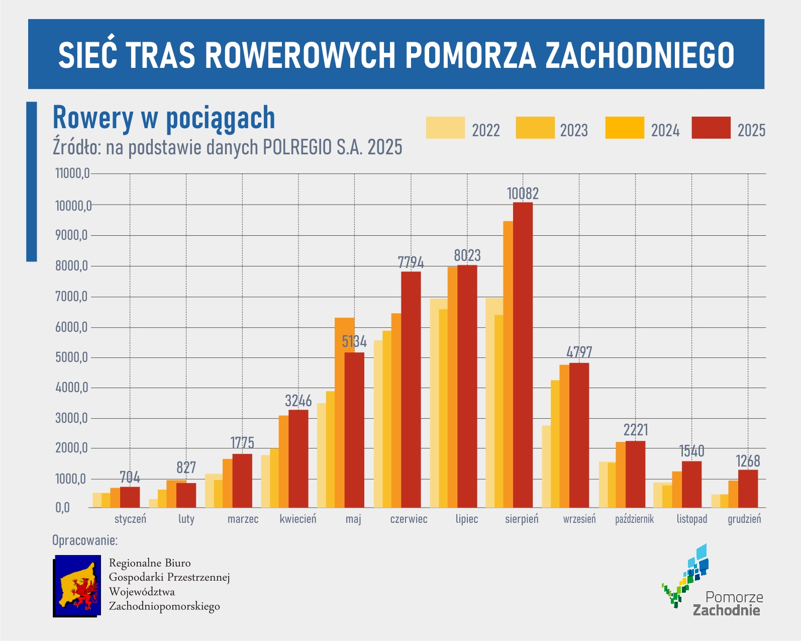
The map ends with data on bicycle transport on POLREGIO regional trains (excluding InterCity trains). As in previous years, the number of bicycles transported increased – by nearly 4% compared to 2024.

The 2025 Cycling Card shows how dynamically the cycling infrastructure in Western Pomerania is developing – from prestigious awards and new investments, through a growing network of routes and Cyclist-Friendly Places, to increasing interest among users and growth in bicycle traffic. The data confirms that the region is consistently building its position as one of the most attractive places for bicycle tourism in Poland.