 Routes and trips
 Map
Map MPR - cyclist-friendly places
 POI
POI Plan your trip
 Bike counters
 Publications
 News
News Route concept
 Contact
Stage I: Siekierki – Trzcińsko-Zdrój – Myślibórz [63 km]
This section is fully completed and mostly runs along an asphalt bicycle path on the embankment of a former railway line.
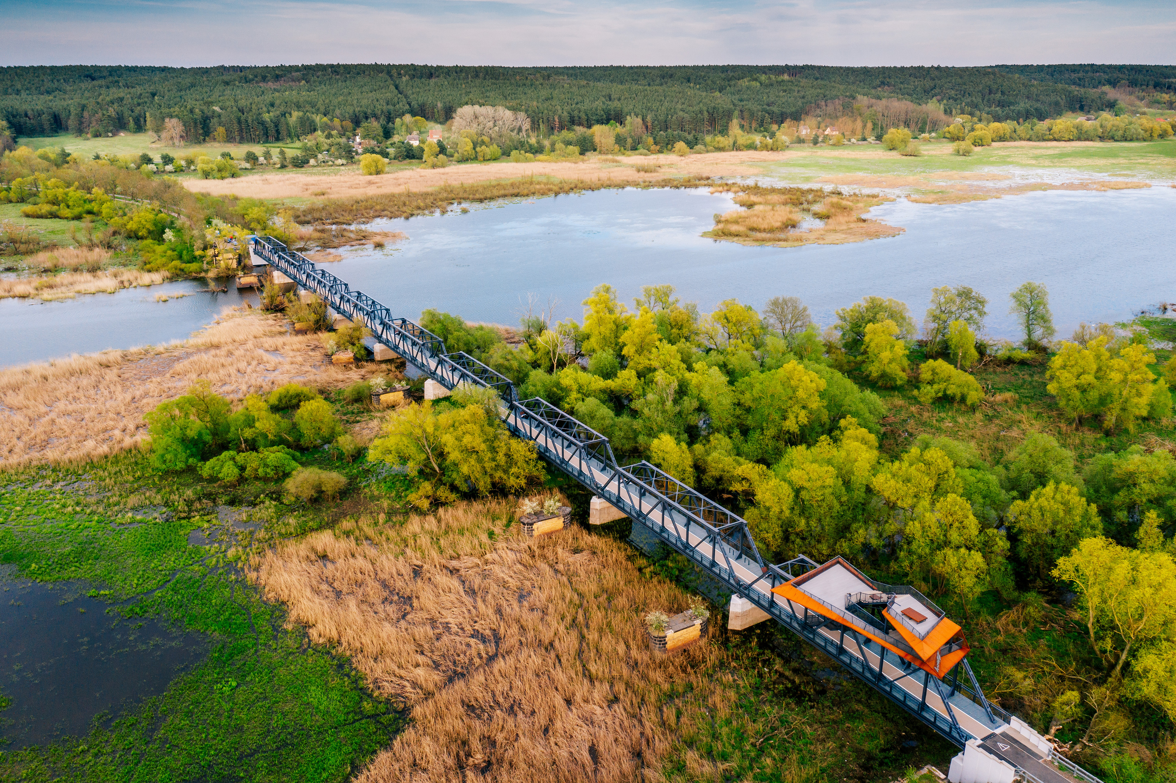
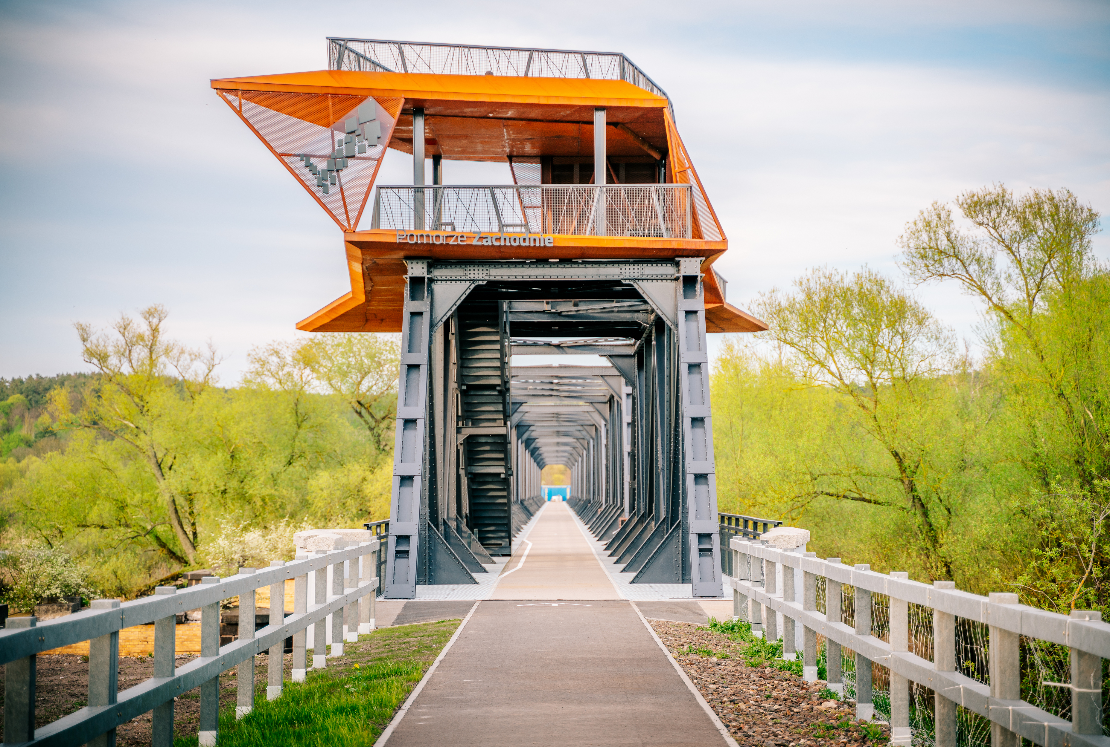
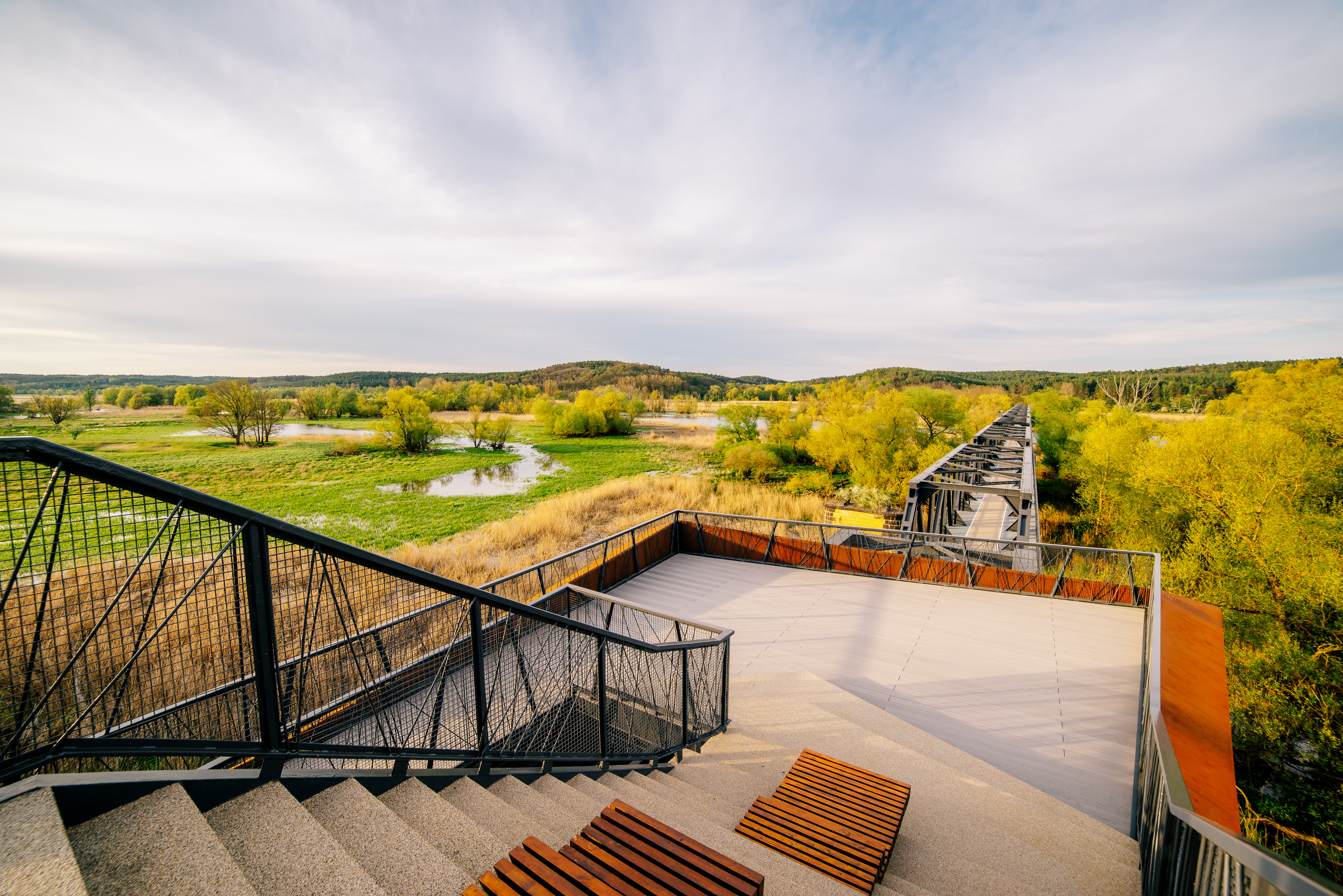
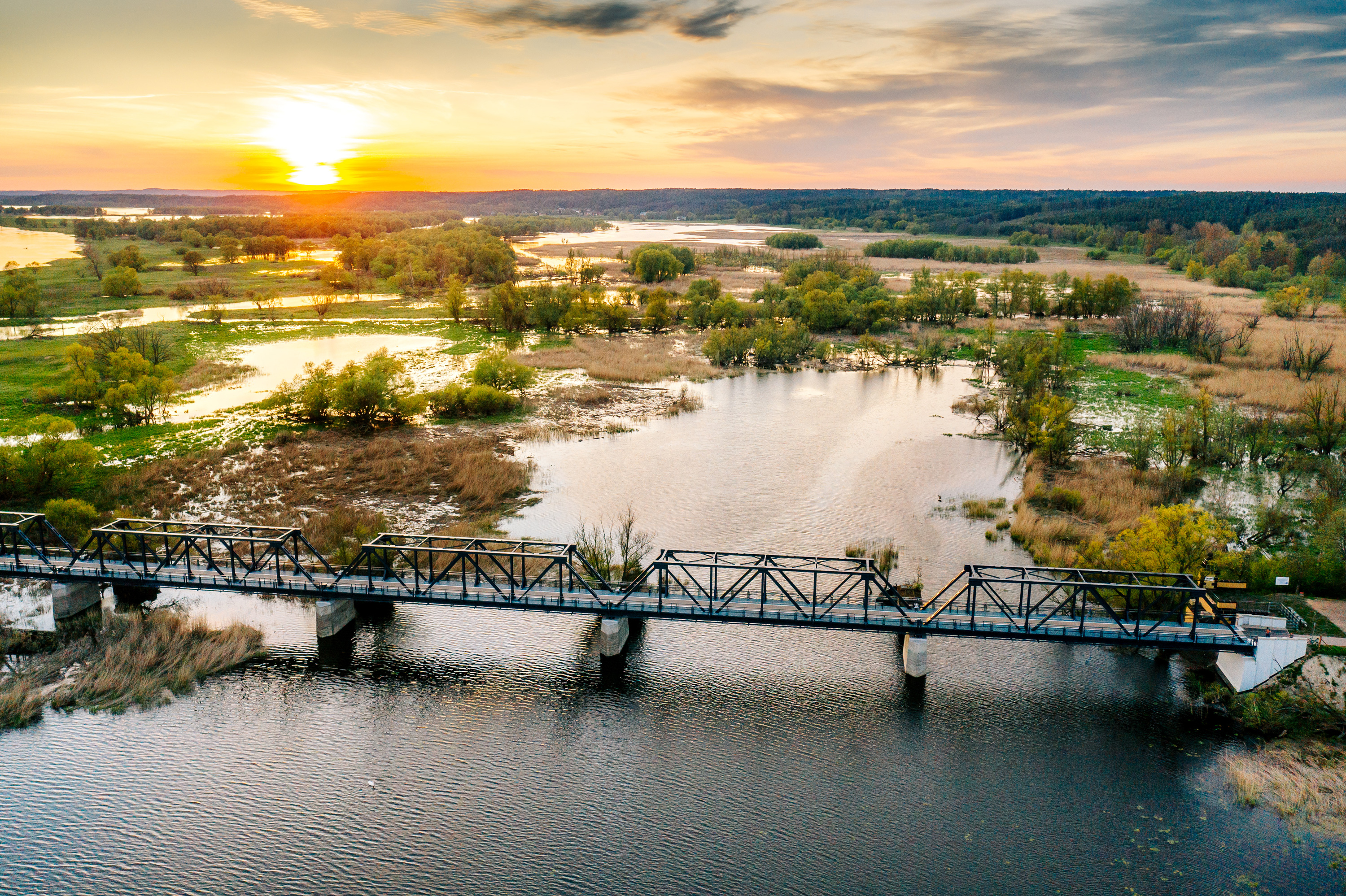
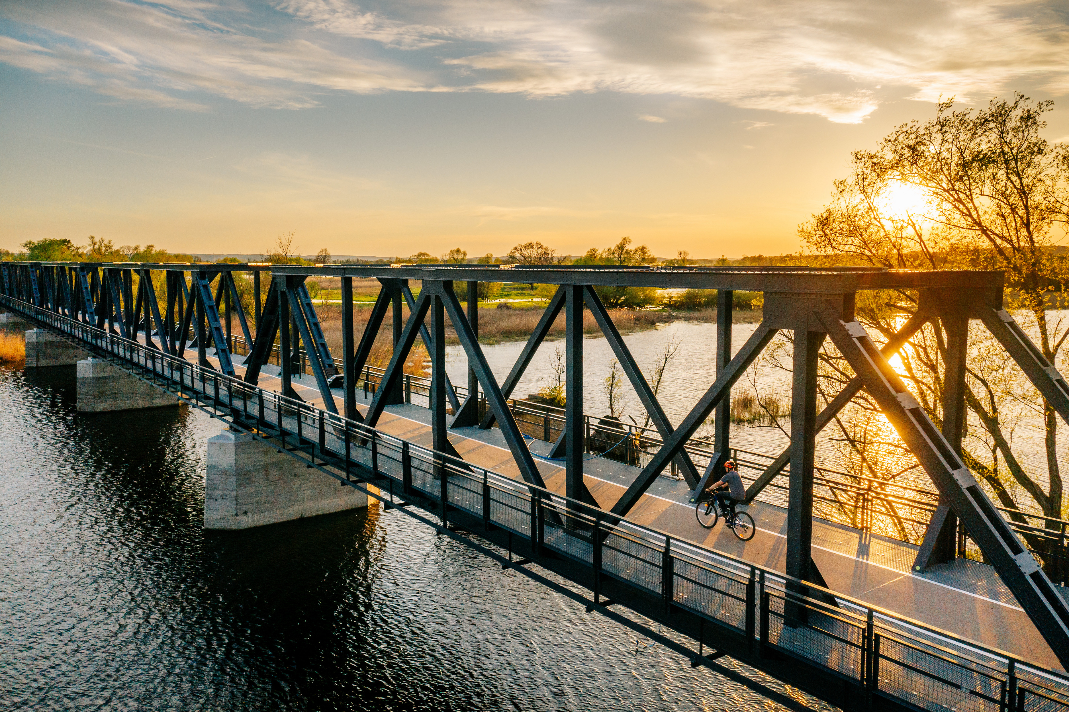
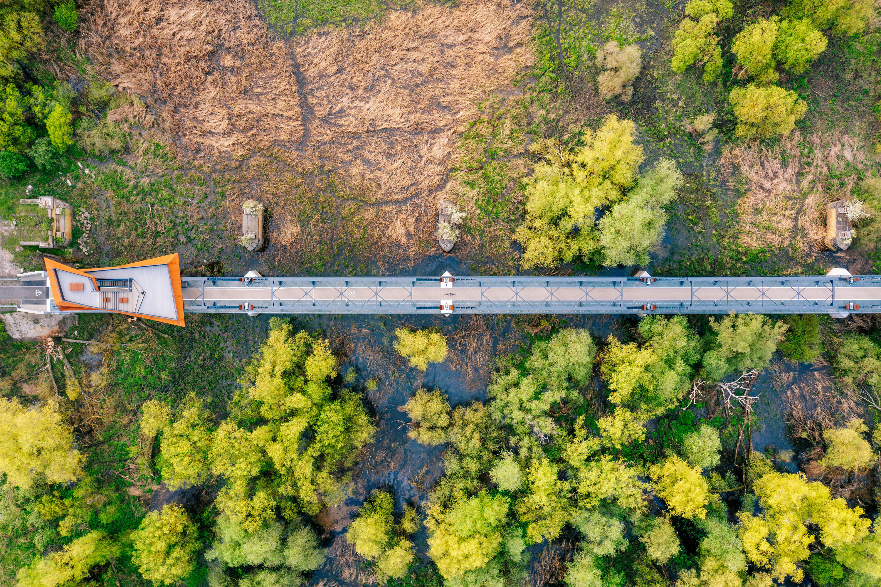
We start at the most spectacular place on the trail and one of the largest cycling investments in Poland. The Siekierki – Neurüdnitz Bridge is the longest crossing on the Oder River, measuring 770 meters. In fact, it consists of two structures, 335 and 325 meters long, connected by a causeway. The bridge, or rather the observation deck located above it, is an amazing vantage point overlooking the Odra floodplains, protected by the Cedynia Landscape Park. It is home to 180 species of birds, which we will certainly see along the route. September is a particularly interesting time, when the rutting season is in full swing and the calls of deer can be heard in the morning and evening across the floodplains.
Built in 1892, the bridge was blown up by the retreating Germans in March 1945, and the existing structure was rebuilt in the 1950s. Interestingly, no civilian passenger train has ever crossed it - the communist authorities intended the bridge to be used exclusively for the transport of Warsaw Pact troops in the event of war with NATO.
The bridge, which had been out of service, deteriorated over the years, but in 2021 it was given a new lease of life as the European Bridge, connecting the bicycle routes of Poland and Germany. The German part of the crossing was opened at the end of June 2022, which makes it possible to plan trips on the other side of the Oder. For example, using the seasonal ferry crossing in Gozdowice, you can make an interesting loop, riding almost all the way along the river itself, or follow the bicycle path towards Mieszkowice and the station.
Just 5 km from Siekierki, it is worth stopping at the War Cemetery of the 1st Polish Army in Stare Łysogórki, commemorating the soldiers who died while crossing the Oder in April 1945. About 2,000 soldiers are buried in the cemetery, and its central point is an 18-meter monument in the shape of two Grunwald swords and a figure of a woman with a child in her arms, symbolizing rebirth after the war. Around it, there are 1,200 concrete crosses, stylized as Grunwald crosses, which remind us of the victims of the battles for Berlin. It is a unique place, combining history with reflection on the region's past.
When traveling from Siekierki, it is impossible not to mention Cedynia, located not far to the north, or rather the Battle of Cedynia. In 972, the army of Mieszko I fought a battle that decided the fate of Western Pomerania for the next decades, which became part of the Piast state.
If we decide to take a trip to Cedynia, 9 kilometers from the European bridge, we will find an obelisk with a telling inscription: "the westernmost point of Poland." The battle itself took place in the vicinity of Mount Czcibora. At its foot, every year in June, a historical picnic and reenactment of the battle take place. The battle scene is also depicted in a monumental mosaic.
However, if we decide to follow the path straight towards Trzcińsko-Zdrój, the former railway station in Klępicz is a must-see. The station quickly gained cult status thanks to Mrs. Jola and her family. It is a place where you can stop, rest, chat, and try the delicious cheesecake baked here.
Six kilometers from Klępicz lies Czachów, famous for its 13th-century Church of Our Lady of Częstochowa, specifically for its paintings. During conservation work in the early 1980s, strange folk paintings were discovered. The thing is, they date back to the 14th century! They are among the oldest polychromes in Poland. The most characteristic and recognizable of the Czachów paintings is the "happy devil" by the baptismal font, and it is worth deviating from the route just to see it. The church is usually closed, but the key is available in the yellow house opposite the church. Ms. Barbara Sobiś lives there and is passionate about telling stories about the paintings and the history of Czachowo.
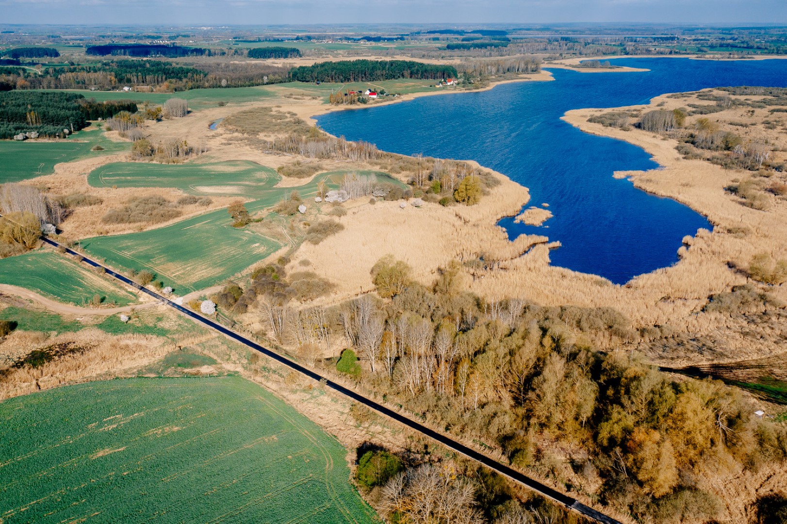
A little closer to the trail (only 2.5 km away) lies the charming town of Moryń. The town is surrounded by an almost circular ring of 15th-century city walls. On Lake Morzycko, the Pleistocene Star Alley was created, also known by the less catchy name of the cross-border geopark "Postglacial Land on the Oder." Huge figures of animals that lived in this area during the Ice Age stand along the avenue. It is a good place to take a selfie with a mammoth or a saber-toothed tiger. The animals are quite realistic, as they are covered with fur that is refreshed every year.
Lake Morzycko itself is considered one of the most attractive bodies of water in the entire country. Its clean, 60-meter-deep waters are a treat not only for water sports enthusiasts but also for divers – at the bottom of the lake lie the remains of a Soviet fighter plane from World War II. This is not the only secret that Moryń hides. Fans of the Pan Samochodzik series may remember that part of the action in "Księga Strachów" (The Book of Fears) takes place here. The mysterious chessboards known from the books can be found on many churches in the area, including in Moryń itself, Dolsk, and Czachowo. On the other side of the lake, in the village of Gądno, there is a classicist palace from 1830, also known from literature, which is slowly being restored from ruins. Every year, the Pan Samochodzik bicycle rally starts from this place.
In Brwice, you can see the largest and oldest sequoia tree in Poland. Next, we enter Trzcińsko-Zdrój, which, like Moryń, is surrounded by well-preserved walls with city gates. The former health resort boasts one of the oldest and most valuable town halls in Poland, dating back to the 13th century. You can relax in the former spa park, admiring the beautiful Spa House, now a nursing home, picturesquely situated on the lake. Trzcińsko-Zdrój is an important junction on the route, where the Western Lake District Route intersects with the Blue Velo route.We endthe stagein Myślibórz.
Transport: PKP railway stations are located in Godków (on the Szczecin-Kostrzyn line) and a few kilometers from the route in Chojna (on the Szczecin-Wroclaw line, long-distance trains stop here) and Mieszkowice. Connections are operated by POLREGIO and Intercity. The timetable can be found at https://portalpasazera.pl. Another railway station serving the route is located 12 km from the bridge in Siekierki in Wriezen on the German side (accessible by Deutsche Bahn trains from Berlin, Frankfurt (Oder), and Eberswalde). The timetable can be found at https://www.bahn.de
Surface: asphalt 99%, slabs + cobblestones <1%.
Type of traffic: bicycle paths 79%, general traffic 21%.


